
Rivers
Why Two Rivers With the Same CFS Can Get Different StrikeTracks Guidance
Cubic feet per second is a volume through a channel, not a universal fishing grade. Two real StrikeTracks rivers show why copying a “good CFS” from one water to another is a planning error.
StrikeTracks Editorial Team2 min read
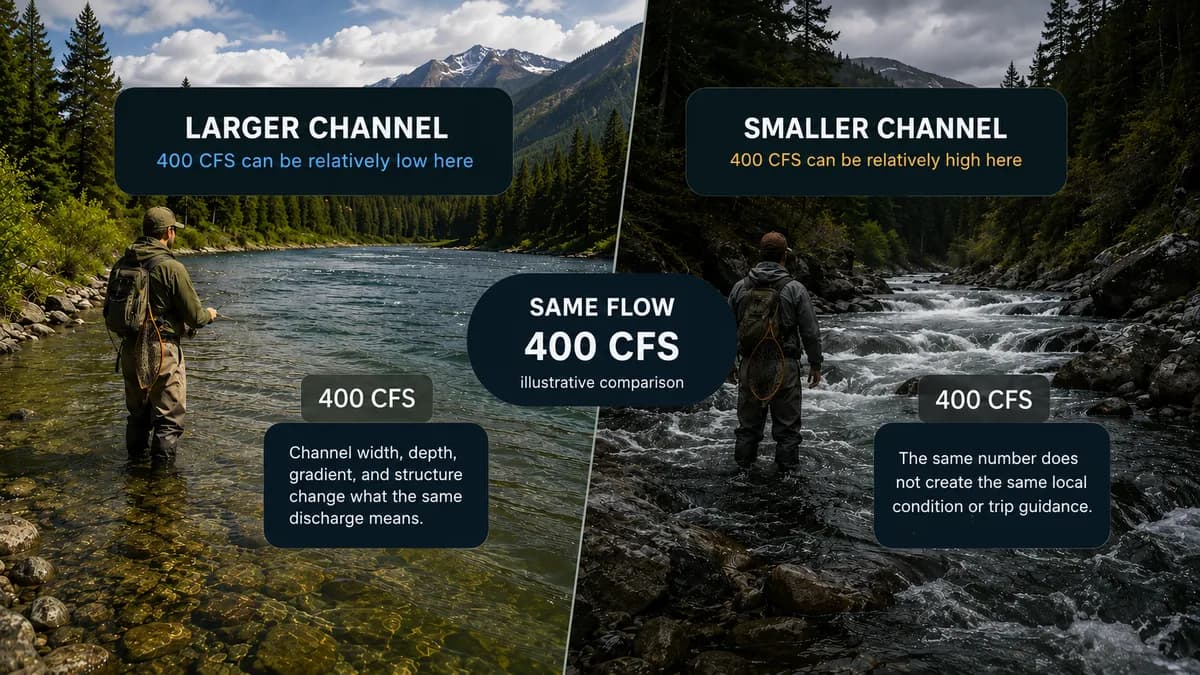
Anglers trade cubic feet per second the way drivers trade miles per hour: as if the number meant the same thing everywhere. It does not. Discharge is the volume of water passing a point in a second. USGS computes it from gage height using a rating that belongs to that site. The same 400 cubic feet per second can be a swollen tailwater on one cataloged river and an almost empty mainstem on another.
A small trout tailwater and a large warmwater mainstem
Swift River at West Ware is the Quabbin release / Winsor Dam corridor in Massachusetts. StrikeTracks assigns USGS 01175500 to that West Ware reach. The catalog’s Good flow band there is 30–80 cfs, with Fair extending to 120 cfs. Rainbow trout and brown trout are the primary fishery targets. The page is not the entire Swift River, and it is not the New Hampshire Swift near Roxbury.
Susquehanna River at Harrisburg is a Pennsylvania capital-city mainstem. StrikeTracks assigns USGS 01570500. The catalog’s Good flow band there is 7,500–19,000 cfs, with Fair extending to 89,000 cfs. Smallmouth bass, walleye, channel catfish, and muskellunge are the principal targets. The page is the Harrisburg gage reach, not the whole Susquehanna basin.
Put the same number on both rivers
Suppose both gages reported 400 cfs. That figure is a teaching comparison, not a live reading copied from either hydrograph today. On the Swift at West Ware, 400 cfs sits far above the catalog Fair ceiling of 120 cfs. Channel scale is a small tailwater. High relative discharge can push wading out of the question even when trout are still in the system. On the Susquehanna at Harrisburg, 400 cfs sits far below the catalog Good floor of 7,500 cfs. The same numeral is a low mainstem. Boat control, exposed bars, and warmwater access look nothing like a blown Massachusetts tailwater.
StrikeTracks does not convert those two 400s into one national grade. Flow guidance is destination-specific. The monitoring relationship is destination-specific. Fishery context is destination-specific. Copying a “good CFS” from a forum post about one river onto the other is how people plan the wrong trip.
What the monitoring relationship actually represents
Each of these pages uses an at-reach USGS site, not a silent remap from a nearby tributary. USGS streamgaging basics still apply: the gage records stage; discharge is computed; the rating is local. StrikeTracks then interprets that discharge against the destination’s own bands and against fishing suitability, which is not wading safety. For how to read the instrument, see How to Read a USGS Stream Gauge for Fishing. For current versus trend on a hydrograph, see How to Read a StrikeTracks River Hydrograph for an Actual Trip.
Why a universal “good CFS” is the wrong question
A useful question is: good for this channel, this reach, these targets, this evidence class? A 50 cfs Swift day can be an ordinary trout window. A 50 cfs Susquehanna day would be an extraordinary low. The product’s job is to keep those interpretations from leaking into each other. If you want the hydrology without the destination bands, USGS is the primary public source. If you want StrikeTracks’ destination contract, open the river page and read the evidence class before you read the number.
Sources and methodology
These are the primary sources this article actually relies on. Linked agencies do not endorse StrikeTracks conclusions.
- USGS streamgaging basics — USGS explains that streamgages measure stage and that discharge is computed with a site-specific stage-discharge rating, not scooped continuously from the river.
- USGS 01175500 — Swift River at West Ware, MA — The monitoring location assigned to StrikeTracks destination Swift River at West Ware. Use the station page for current and historical stage and discharge; this article does not invent a live reading.
- USGS 01570500 — Susquehanna River at Harrisburg, PA — The monitoring location assigned to StrikeTracks destination Susquehanna River at Harrisburg.
- MassWildlife — Massachusetts freshwater fishing regulations, stocking reports, and trout-water management are authoritative for Swift River at West Ware and Charles River at Waltham. Confirm current rules before you go.
- Pennsylvania Fish and Boat Commission — Pennsylvania fishing regulations and inland fishery information for Susquehanna River at Harrisburg and Allegheny Reservoir.
- StrikeTracks Research & Methodology — StrikeTracks destination flow bands and reach identity come from the catalog for Swift River at West Ware and Susquehanna River at Harrisburg. Those bands are destination-specific planning ranges, not a national CFS scale.
Related Fishing Insights
- How to Read a USGS Stream Gauge for Fishing
USGS streamgages report water level and often compute discharge. Learn what gage height, flow, and temperature mean for trip planning — and what they never tell you by themselves.
- How River Flow Affects Fishing Conditions
Flow changes how a river fishes, how it looks, and how safely you can enter it. This article explains discharge in angler terms and how StrikeTracks uses destination-specific flow context.
- How to Read a StrikeTracks River Hydrograph for an Actual Trip
A hydrograph is a history, not a single tick. Using Swift River at West Ware, this article separates latest discharge from trend, and fishing suitability from wading safety.