Rudee Inlet / Virginia Beach is a compact Atlantic inlet fishery built around jetties, current, nearby beach water, and the connection to sheltered marina channels. Spotted seatrout, summer flounder, and bluefish are the principal supported targets.
Active coastal or marine alerts
Gale Warning
Severity: Moderate
Gale Warning issued October 20 at 2:17AM EDT until October 21 at 7:00PM EDT by NWS Wakefield VA
Begins Oct 20, 2026, 2:17 AM · Ends Oct 21, 2026, 7:00 PM
Mariners should alter plans to avoid these hazardous conditions. Remain in port, seek safe harbor, alter course, and/or secure the vessel for hazardous conditions.
Virginia · Mid-Atlantic / Virginia Eastern Shore · Shore
Approximately 23.1 miles away
Predicted Tides
Predicted
Falling
Next low tide
Oct 20, 2026, 9:10 AM
In 1 hr 27 min
1.1 ft MLLW
Previous
High · Oct 20, 2026, 3:18 AM · 2.9 ft MLLW
Following
High · Oct 20, 2026, 3:33 PM · 3.4 ft MLLW
Tide station at destination
Rudee Inlet / Virginia Beach · NOAA 8639208
Predicted Tidal Current
Predicted
Tidal-current predictions are not available for this destination.
Tidal-current timing can differ from high and low tide timing.
Fishery Profile
Fishery Overview
Rudee Inlet Atlantic pass fishery
A Virginia Beach Atlantic inlet fishery at Rudee Inlet. Owl Creek Boat Ramp provides public boat access to the inlet and ocean. City rules regulate beach fishing at the Rudee Inlet end of the resort beach; fishing is prohibited on the Owl Creek ramp docks and city shore at that property. Jetty walking is not confirmed as open.
Fishery type
Atlantic inlet pass
Fishing modes
Shore
Inshore boat
Habitat and structure
Rudee Inlet throat between the oceanfront and Owl Creek · Inlet channel edges and adjacent ocean surf at the resort/Croatan boundary · Harbor and creek water inside the inlet used by boats launching at Owl Creek
Static seasonal guidance · Last reviewed Aug 16, 2026
Not a live bite forecast.
Fishery Targets
VMRC names Rudee Inlet for speckled trout and summer flounder and lists inlets among bluefish waters. Listed species are not typical every month. Harvest seasons are not biological calendars. Seasonal notes, where present, describe typical presence.
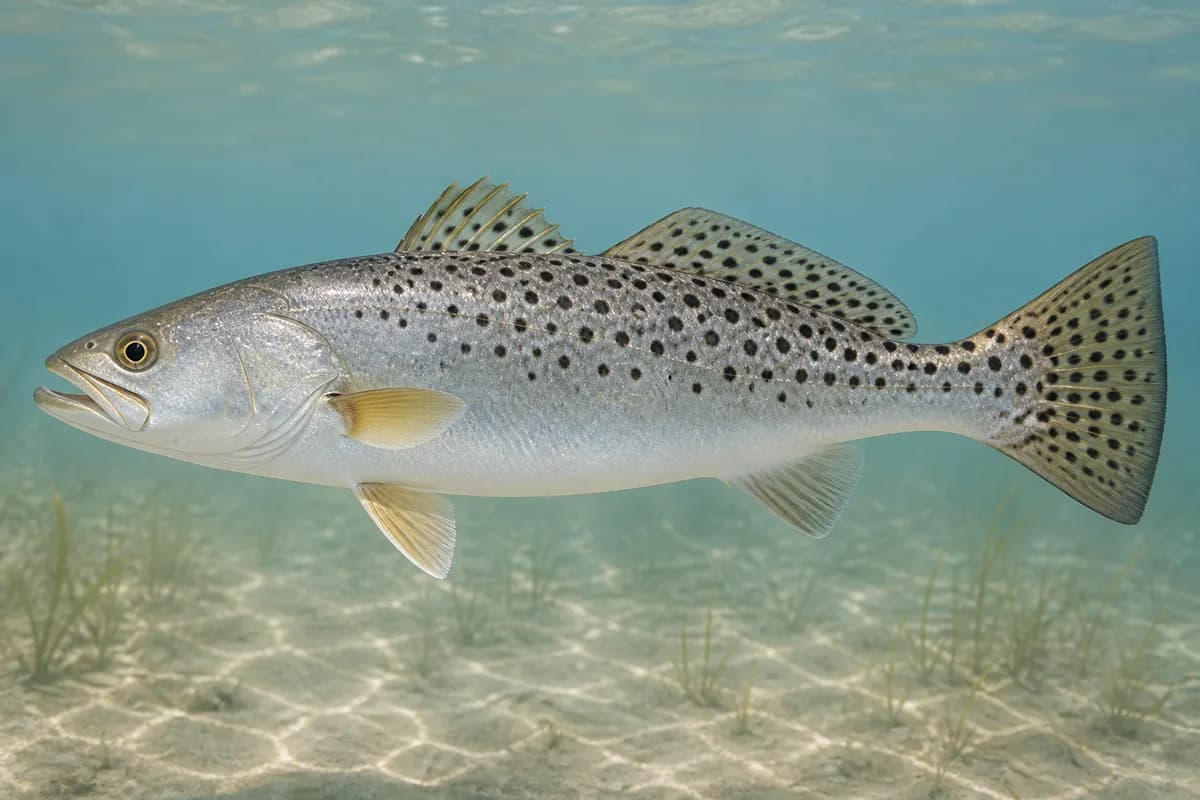
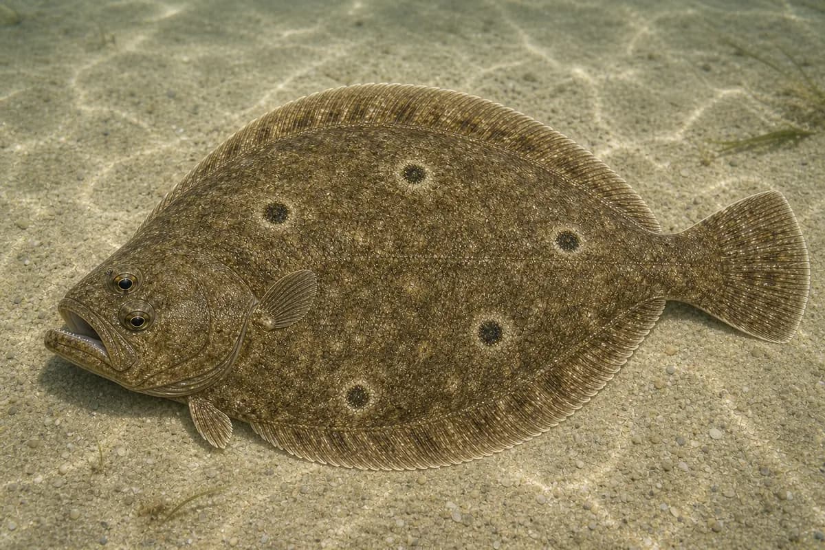
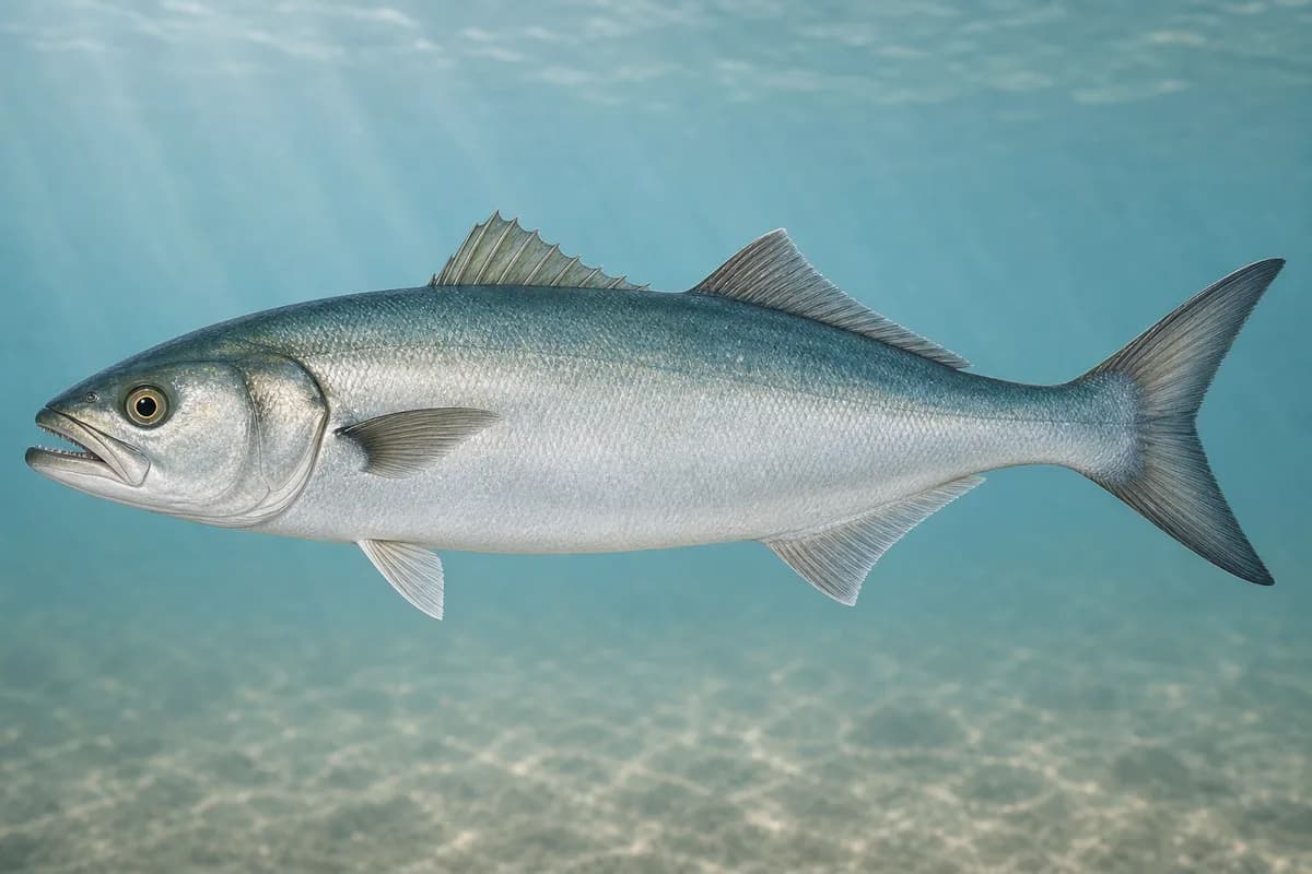
Species images are AI-generated illustrations for visual reference and may simplify natural variation. Fishery records are based on the cited agency and editorial sources. About fish illustrations
Spotted seatrout
Primary
Cynoscion nebulosus
Currently in a typical seasonal window
Typical seasonal window: MAY — JUNE; SEPTEMBER — NOVEMBER
VMRC Angler's Guide names Rudee Inlet among spring and fall speckled trout locations.
Summer flounder
Primary
Paralichthys dentatus
Typical seasonal window: MAY — JULY
VMRC lists Rudee Inlet among summer flounder locations.
Bluefish
Secondary
Pomatomus saltatrix
Currently in a typical seasonal window
Typical seasonal window: MAY — OCTOBER
VMRC lists bluefish in Chesapeake Bay, coastal ocean, surf, and inlets. Rudee is an Atlantic inlet.
Typical Seasonal Targets
Spotted seatrout — MAY — JUNE; SEPTEMBER — NOVEMBER
Summer flounder — MAY — JULY
Bluefish — MAY — OCTOBER
Seasonal presence is general guidance and does not indicate current fish activity.
How to Fish Rudee Inlet / Virginia Beach
Typical October approaches include inlet and beach casting for Spotted seatrout and Bluefish.
Inlet and beach casting
Cast paddle tails, bucktails, and plugs along inlet current and the adjacent ocean beach for seatrout and bluefish, subject to city beach-fishing hours.
Best for
Spotted seatrout
Bluefish
Modes
Shore
Inshore boat
Setup
Rudee Inlet casting setup
Common Tackle Setups
Rudee Inlet casting setup
Shore or boat spinning tackle for seatrout and bluefish at the inlet.
Rod
Medium spinning rod; a longer rod helps in surf.
Reel
Spinning reel with a reliable drag.
Main line
Braided main line.
Leader
Abrasion-resistant leader; heavier if bluefish are chopping.
Terminal tackle
Jig heads matched to inlet current.
Presentation
City beach-fishing hours apply on the resort sand toward Rudee Inlet.
Used for
Inlet and beach casting
Typical October Lures and Flies
Common lure and fly families associated with this month’s techniques.
Surface popper
Lure
Spotted seatrout
Bluefish
Surface · Twitch, pause
Use short pops rather than constant noise in clear or pressured water
Minnow-style swimming plug
Lure
Spotted seatrout
Bluefish
Shallow to midwater · Steady, twitch, pause
Cast across seams and let the plug track with the current
Soft-plastic paddle tail
Lure
Spotted seatrout
Bluefish
Shallow, Midwater, Variable · Steady, twitch, jig
Swim steadily through seams or hop lightly near bottom transitions
Hop, swim, or drift depending on depth and current speed
General seasonal guidance, not a live recommendation, product endorsement, or guarantee of success.
Access, Safety and Regulations
Access
Public boat access is the City of Virginia Beach Owl Creek Boat Ramp at 717 General Booth Boulevard, with concrete launch lanes and direct access to Rudee Inlet and the Atlantic. The city prohibits fishing, crabbing, or net fishing on the dock, kayak launch, mooring areas, and shore along that city property. Beach fishing on the resort sand toward Rudee Inlet is a regulated municipal activity with seasonal daytime prohibitions. Public walking access on the inlet jetties is not confirmed. Confirm current ramp construction, beach-fishing hours, and overflow-parking status before you go.
Primary hazards
Narrow-inlet boat traffic, strong current, surf, and seasonal beach-fishing restrictions are the primary hazards. Owl Creek has posted ramp-extension work and a temporarily closed ADA kayak launch.
Fishery considerations
Wind against the inlet can steepen the throat. Offshore buoy 44014 is not a local inlet wave source.
Regulations
Size limits, seasons, and possession rules change. Verify the current official regulations before fishing.
The map marker represents the cataloged waterbody or monitoring location and may not indicate legal parking or public access. Confirm access through the official information before visiting.