Kiptopeke / Cape Charles is a lower Chesapeake Bay shore fishery centered on beaches, piers, artificial structure, and open bay water along Virginia's Eastern Shore. Tautog, striped bass, summer flounder, cobia, and black drum are the principal supported targets.
Active coastal or marine alerts
Coastal Flood Watch
Severity: Moderate
The Coastal Flood Watch has been replaced. Please see the latest information from NWS Wakefield VA on this developing situation.
Begins Oct 21, 2026, 1:00 AM · Ends Oct 21, 2026, 10:00 PM
If travel is required, allow extra time as some roads may be closed. Do not drive around barricades or through water of unknown depth. Take the necessary actions to protect flood-prone property. Inexperienced swimmers should remain out of the water due to dangerous surf condit…
High Surf Advisory issued October 19 at 2:45PM EDT until October 21 at 7:00PM EDT by NWS Wakefield VA
Begins Oct 19, 2026, 2:45 PM · Ends Oct 21, 2026, 7:00 PM
If travel is required, allow extra time as some roads may be closed. Do not drive around barricades or through water of unknown depth. Take the necessary actions to protect flood-prone property. Inexperienced swimmers should remain out of the water due to dangerous surf condit…
Coastal Flood Advisory issued October 19 at 2:45PM EDT until October 22 at 12:00AM EDT by NWS Wakefield VA
Begins Oct 20, 2026, 12:00 PM · Ends Oct 22, 2026, 12:00 AM
If travel is required, allow extra time as some roads may be closed. Do not drive around barricades or through water of unknown depth. Take the necessary actions to protect flood-prone property. Inexperienced swimmers should remain out of the water due to dangerous surf condit…
Tidal-current predictions are not available for this destination.
Tidal-current timing can differ from high and low tide timing.
Fishery Profile
Fishery Overview
Kiptopeke / Cape Charles concrete-ship and pier fishery
A lower-Chesapeake Eastern Shore fishery at Kiptopeke State Park and the Cape Charles reach. Concrete ships form a breakwater reef, with a lighted fishing pier, south beach, and park boat ramp.
Fishery type
Bay pier breakwater
Fishing modes
Shore
Inshore boat
Habitat and structure
World War II concrete ships forming a harbor breakwater reef · Lighted Kiptopeke State Park fishing pier · South beach surf and park boat-ramp water on the lower Bay
Static seasonal guidance · Last reviewed Aug 16, 2026
Not a live bite forecast.
Fishery Targets
Virginia State Parks and VMRC support tautog, striped bass, summer flounder, cobia, and black drum at Kiptopeke / Cape Charles structure. Listed species are not typical every month. Harvest seasons are not biological calendars. Seasonal notes, where present, describe typical presence.
This reflects typical biological/fishery timing, not a legal open season. Check current regulations before fishing.
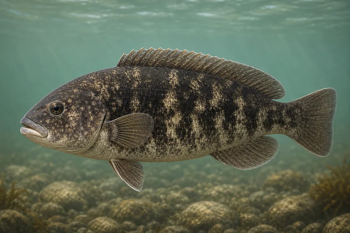
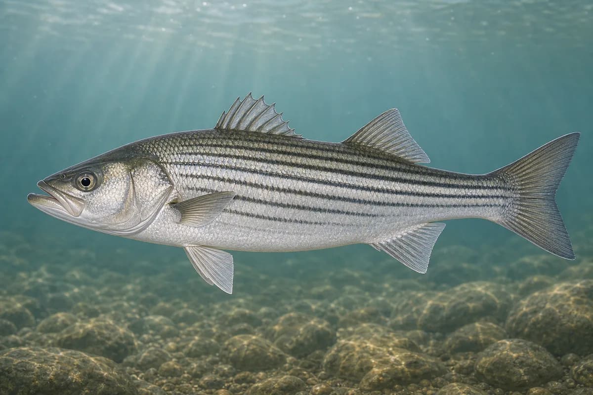
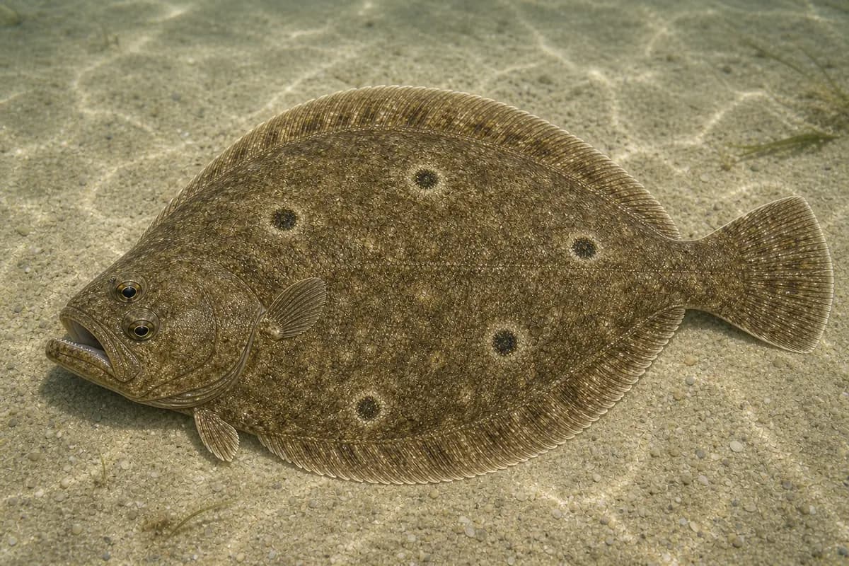
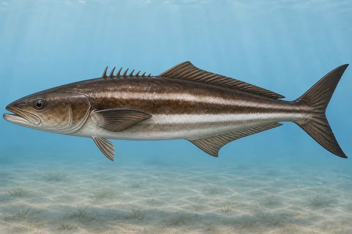
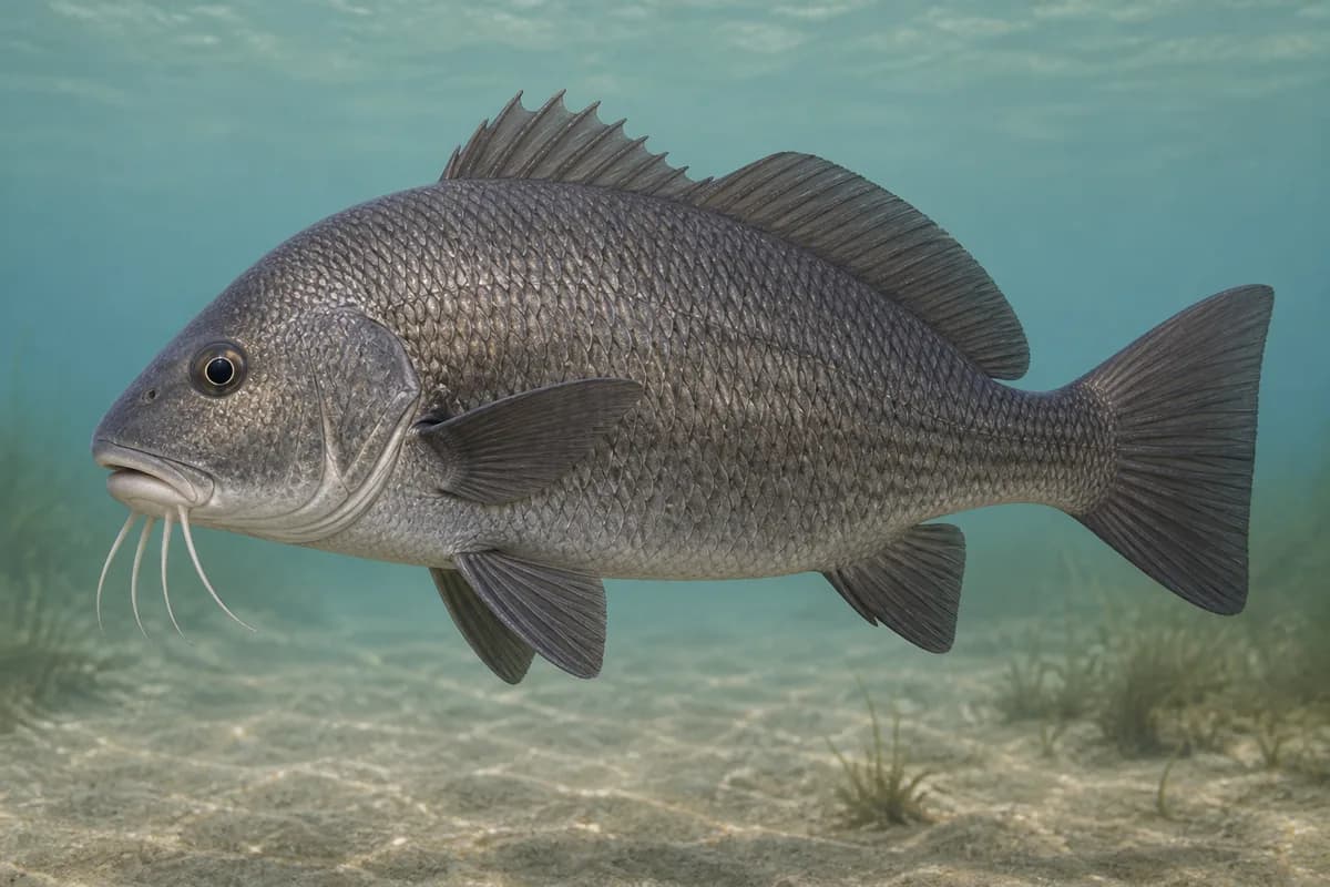
Species images are AI-generated illustrations for visual reference and may simplify natural variation. Fishery records are based on the cited agency and editorial sources. About fish illustrations
Tautog
Primary
Tautoga onitis
Currently in a typical seasonal window
Typical seasonal window: MARCH — JUNE; OCTOBER — DECEMBER
May also be present outside this peak window.
Virginia State Parks describes the concrete ships as some of Virginia's finest fishing structure. VMRC places tautog on lower-Bay wrecks and obstructions.
Striped bass
PrimaryRegulations vary annually
Morone saxatilis
Typical seasonal opportunity: SPRING AND FALL
VMRC names large striped bass along the Eastern Shore / Cape Charles reach of the lower Bay. Park pier and ship structure fishing; harvest dates are regulation dates.
Summer flounder
Secondary
Paralichthys dentatus
Currently in a typical seasonal window
Typical seasonal window: JULY — OCTOBER
VMRC lists lower Chesapeake Bay among flounder waters; the pier and ship edges are the local class.
Cobia
Seasonal
Rachycentron canadum
Typical seasonal window: MAY — SEPTEMBER
VMRC names Cabbage Patch and Kiptopeke areas off Cape Charles among cobia locations.
Black drum
Seasonal
Pogonias cromis
Typical seasonal window: MAY — JUNE
VMRC names the Cape Charles / Kiptopeke bayside channel ledge among black drum locations.
Typical Seasonal Targets
Tautog — MARCH — JUNE; OCTOBER — DECEMBER
Striped bass — SPRING AND FALL
Summer flounder — JULY — OCTOBER
Cobia — MAY — SEPTEMBER
Black drum — MAY — JUNE
Seasonal presence is general guidance and does not indicate current fish activity.
How to Fish Kiptopeke / Cape Charles
Typical October approaches include concrete-ship structure fishing and pier and beach casting for Tautog and Summer flounder.
Concrete-ship structure fishing
Fish tautog and structure jigs on the concrete ships from shore-adjacent water or boat.
Best for
Tautog
Modes
Shore
Inshore boat
Setup
Kiptopeke concrete-ship setup
Pier and beach casting
Cast bucktails and swimming plastics from the lighted pier and south beach for striped bass, flounder, and cobia.
Best for
Summer flounder
Modes
Shore
Inshore boat
Setup
Kiptopeke pier casting setup
Common Tackle Setups
Kiptopeke concrete-ship setup
Heavier tackle to hold on the concrete-ship reef.
Rod
Medium-heavy rod for rock and current.
Reel
Reel with a solid drag.
Main line
Abrasion-resistant braid.
Leader
Heavy leader for barnacles.
Terminal tackle
Tautog and structure jigs.
Presentation
Keep baits on the ships; they are the park's defining structure.
Used for
Concrete-ship structure fishing
Kiptopeke pier casting setup
Shore spinning tackle for the lighted pier and south beach.
Rod
Medium to medium-heavy spinning rod.
Reel
Spinning reel with a reliable drag.
Main line
Braided main line.
Leader
Abrasion-resistant leader.
Terminal tackle
Jig heads matched to current.
Presentation
Park lights attract bait to the pier.
Used for
Pier and beach casting
Typical October Lures and Flies
Common lure and fly families associated with this month’s techniques.
Soft-plastic jig head
Lure
Tautog
Midwater, Bottom, Variable · Jig, slow, drift
Keep intermittent bottom contact around structure and soft edges
Tautog jig
Lure
Tautog
Bottom · Jig, slow
Keep the jig close to structure and move it in short lifts
Reef and structure jig
Lure
Tautog
Bottom · Jig, slow
Maintain near-bottom contact without burying the jig in snags
Hop, swim, or drift depending on depth and current speed
Fluke bucktail presentation
Lure
Summer flounder
Bottom to shallow · Drift, jig, slow
Maintain intermittent bottom contact across edges and transitions
General seasonal guidance, not a live recommendation, product endorsement, or guarantee of success.
Access, Safety and Regulations
Access
Public access is Kiptopeke State Park. Virginia DCR posts a lighted fishing pier open 24 hours a day April 1 through December 31, with pier fees, a boat ramp, and south-beach surf fishing. Confirm current pier hours rather than assuming year-round 24-hour access. No fishing license is required from the pier, but anglers 16 and older without a Virginia saltwater license must register for the free Virginia Fisherman Identification Program; shore fishing requires a Virginia saltwater license or a Maryland license with a valid Virginia FIP number. Confirm current pier fees, ramp status, and beach rules before you go.
Primary hazards
Open-Bay chop, unguarded swimming beach, and concrete-ship structure are the primary hazards.
Fishery considerations
Current predictions and a local wave reading are not available here.
Open lower-Bay wind can steepen chop on the pier and ships.
Regulations
Size limits, seasons, and possession rules change. Verify the current official regulations before fishing.
The map marker represents the cataloged waterbody or monitoring location and may not indicate legal parking or public access. Confirm access through the official information before visiting.