Coastal conditions

Duck / Northern Outer Banks

Shore · North Carolina · Mid-Atlantic / Northern Outer Banks

Current Coastal Rating

Fair · 56

Beta

Conditions are fair, but confidence is reduced because some coastal inputs are partial or prediction-based.

Scores are model-specific and are not directly comparable across water types.

Should I Go?

Trip conditions only. Target-species activity and seasonal fishery patterns are not yet included.

Consider

Trip conditions may be workable, but important cautions or data limitations remain.

High confidence in the evaluated inputs — observational coverage is partial. Required data sources were available and the key inputs were current.

Evaluates trip conditions using weather, tides, currents, waves, daylight, and active alerts.

  • Provisional public-Beta coastal rating. Methodology is not formally calibrated.
  • Numeric class: NEEDS_BOUNDED_PRODUCT_POLICY_DEFAULTS. Not an empirical fishing freeze.
  • Does not inherit Northeast or cross-region fishing thresholds.
  • Missing waves are not calm. Forecast is not an observation. Prediction is not an observation.
  • Verdict capped at Consider while calibration remains incomplete or evidence is limited.

About this recommendation

Uses StrikeTracks coastal policy 2026-07.

Service Status

Degraded

Coastal conditions are partial, stale, or predictions-only.

Recommended window

Saturday · 9:00 AM–12:00 PM EDT

Window score

81

Max wind
5 mph
Max gust
11 mph
Daylight
100% of window
Tide state
rising

Why

  • Strong daylight coverage supports the evaluated window.

Current Readings

Updated Sep 5, 2026, 3:50 AM

NOAA Station

NOAA Station selected

Source

  • NOAA CO-OPS
  • Duck station
  • 0.0 mi from destination
Water level
3.4 ft MLLW

Updated 9 min ago

Water temperature
75.9°F

Updated 9 min ago

Wind
NW · 5 mph

Updated 9 min ago

Wind gust
8 mph

Updated 9 min ago

Past 7 Days

NOAA Station

NOAA Station selected

Water level

Window Aug 29, 2026, 3:50 AM Sep 5, 2026, 3:50 AM (rolling 168 hours)

Water level over the past 7 days. 1679 observations · from Aug 29, 2026, 3:54 AM · to Sep 5, 2026, 3:42 AM Range 0.1 ft MLLW to 4.8 ft MLLW.

Readings increased over the available period.

1679 observations · from Aug 29, 2026, 3:54 AM · to Sep 5, 2026, 3:42 AM

  • NOAA CO-OPS · Duck · Station 8651370
  • Station at destination
  • Approximately 0.0 mi from destination
  • Observation type: observed
  • Unit: ft
  • Datum: MLLW

Nearby coastal destinations

  • North Carolina · Mid-Atlantic / Northern Outer Banks · Shore

    Approximately 20.8 miles away

  • North Carolina · Mid-Atlantic / Northern Outer Banks · Inlet

    Approximately 29 miles away

  • Virginia · Mid-Atlantic / Virginia Capes · Inlet

    Approximately 46.5 miles away

Predicted Tides

Predicted

Falling

Next low tide

Sep 5, 2026, 8:13 AM

In 4 hr 22 min

0.6 ft MLLW

Previous

High · Sep 5, 2026, 2:01 AM · 3.0 ft MLLW

Following

High · Sep 5, 2026, 2:51 PM · 4.0 ft MLLW

Tide station at destination

Duck · NOAA 8651370

Predicted Tidal Current

Predicted

No representative tidal-current prediction station is configured for this destination.

Tidal-current timing can differ from high and low tide timing.

Fishery Profile

Fishery Overview

Duck / northern Outer Banks pier and surf fishery

A northern Outer Banks Atlantic ocean and pier fishery at Duck. The USACE Field Research Facility pier and adjacent surf are the bounded identity. This is not Oregon Inlet, not Hatteras, and not a generic Albemarle Sound row.

Fishery type
  • Ocean pier surf
Fishing modes
  • Shore
Habitat and structure
Duck Pier / FRF ocean pier deck and pilings · Adjacent northern Outer Banks surf and bar

Static seasonal guidance · Last reviewed Aug 23, 2026

Not a live bite forecast.

Fishery Targets

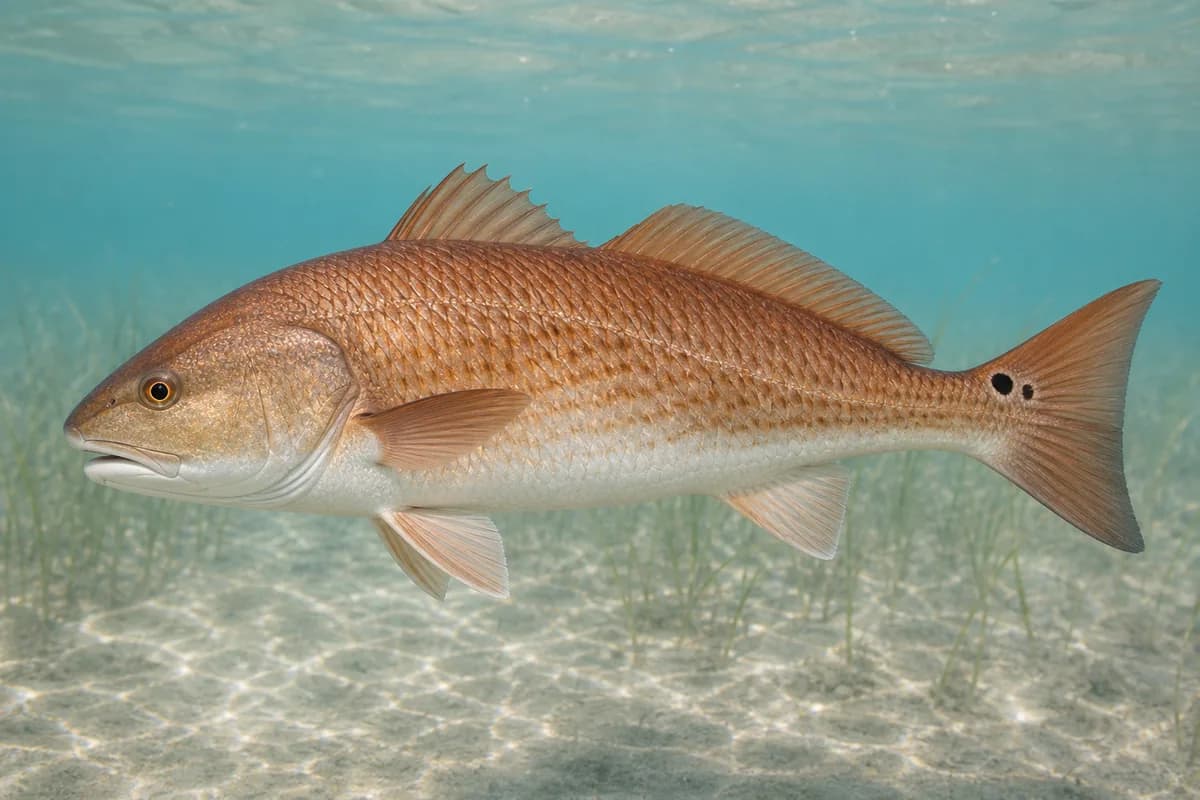
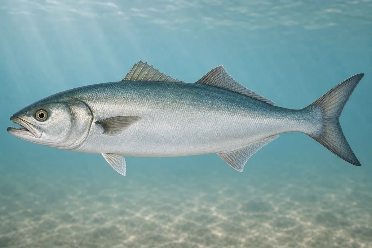
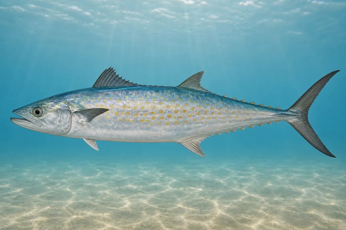
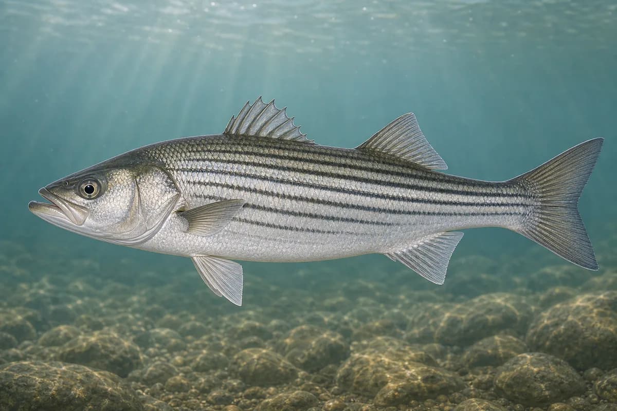
Striped bass, red drum, bluefish, and Spanish mackerel are the representative surf and pier targets. Seasonal movement is qualitative; month endpoints are not manufactured.

This reflects typical biological/fishery timing, not a legal open season. Check current regulations before fishing.

Species images are AI-generated illustrations for visual reference and may simplify natural variation. Fishery records are based on the cited agency and editorial sources. About fish illustrations

  • Striped bass illustration

    Striped bass

    PrimaryRegulations vary annually

    Morone saxatilis

    Typical seasonal opportunity: WINTER — SPRING

    Northern Outer Banks surf and pier occurrence; harvest dates are not encoded as windows.

  • Red drum illustration

    Red drum

    Primary

    Sciaenops ocellatus

    Also called Redfish

    Typical seasonal opportunity: SPRING AND FALL

    May also be present outside this peak window.

    NC DMF lists red drum among coastal recreational species. Surf and wash occurrence.

  • Bluefish illustration

    Bluefish

    Secondary

    Pomatomus saltatrix

    No seasonal pulse known

    Coastal migratory occurrence along the northern Outer Banks.

  • Spanish mackerel illustration

    Spanish mackerel

    Secondary

    Scomberomorus maculatus

    Typical seasonal opportunity: SPRING — FALL

    Warm-season pier and surf occurrence; timing is not given exact month endpoints.

Typical Seasonal Targets

  • Striped bass — WINTER — SPRING
  • Red drum — SPRING AND FALL
  • Spanish mackerel — SPRING — FALL

Seasonal presence is general guidance and does not indicate current fish activity.

Access, Safety and Regulations

Access

Public pier and beach access at Duck / Corolla-area northern Outer Banks. Confirm current pier hours, fees, and town beach rules before visiting. Private oceanfront is not implied public access.

Primary hazards

Ocean swell, pier spray, and nor'easter wind are the main hazards. Do not treat missing wave observations as calm seas.

Fishery considerations

  • Tidal current is not a pier-deck scoring input.
  • Onshore wind steepens the wash. Missing waves are not calm. Forecast is not an observation.

Regulations

Size limits, seasons, and possession rules change. Verify the current official regulations before fishing.

Location and Access

Cataloged coastal fishing destination

Shore · North Carolina

Loading map…

The map marker represents the cataloged waterbody or monitoring location and may not indicate legal parking or public access. Confirm access through the official information before visiting.

Data Sources

Planning limitation

Coastal conditions can vary over short distances. Predictions and remote observations are planning information, not guarantees of access or safety.

  • This is a northern Outer Banks ocean/pier identity, not an inlet and not Albemarle Sound.
  • Waves are unsupported. Nearby shelf buoys are not at-location Duck surf.
  • Tidal currents are not applicable on the pier deck.