Coastal conditions

Kona / Honokohau Harbor

Harbor · Hawaii · Hawaii Island / Kona / Honokohau Harbor

Active coastal or marine alerts

  • Small Craft Advisory

    Severity: Minor

    Small Craft Advisory issued September 4 at 3:51PM HST until September 5 at 6:00PM HST by NWS Honolulu HI

    Begins Sep 4, 2026, 3:51 PM · Ends Sep 5, 2026, 6:00 PM

    Inexperienced mariners, especially those operating smaller vessels, should avoid navigating in these conditions.

    Official NWS alert

Current Coastal Rating

Poor · 42

Beta

Conditions are poor. Review the details below before heading out.

Scores are model-specific and are not directly comparable across water types.

Should I Go?

Trip conditions only. Target-species activity and seasonal fishery patterns are not yet included.

Consider

Trip conditions may be workable, but important cautions or data limitations remain.

Medium confidence The recommendation is usable, but one or more inputs are regional, proxied, stale, or incomplete.

Evaluates trip conditions using weather, tides, currents, waves, daylight, and active alerts.

  • Policy HAWAII_PATH2_PROVISIONAL_POLICY_V1. Authority OWNER_AUTHORIZED_PROVISIONAL_PRODUCT_POLICY.
  • Provisional conservative non-empirical Hawaii product-policy. Not accepted Hawaii fishing thresholds. Not PATH1. Not calibrated V1 science.
  • NWS Hawaii SCA / Gale issuance floors are safety anchors, not optimal fishing cuts.
  • Does not inherit Northeast, Mid-Atlantic, Southeast, Gulf, PSW, or PNW numerics or weights.
  • empiricalCalibratedFishingThresholds=false. hawaiiSpecificWeights=false. productionThresholdsAuthorized=false. path1Authorized=false.
  • Missing waves are not calm. Forecast is not an observation. Prediction is not an observation.
  • Offshore wind is not automatically favorable. Wind direction is required evidence with neutral initial score contribution.
  • Exposure Hawaii W LEE shelter=HARBOR.
  • Verdict capped at Consider while calibration remains incomplete. Adverse Wait / Do Not Go / Unavailable are not weakened.
  • Pelagic wave is optional/abstaining. Tide is context-only and is not scored.

About this recommendation

Uses StrikeTracks coastal policy 2026-07.

Recommended window

Saturday · 6:00 AM–9:00 AM HST

Window score

62

Max wind
4 mph
Max gust
8 mph
Daylight
67% of window
Tide state
rising

Watch for

  • An active caution-level alert applies to this destination.

Coastal conditions can change quickly. Review official alerts and current conditions before heading out.

Current Readings

Updated Sep 4, 2026, 9:50 PM

NOAA Station

NOAA Station selected

Source

  • NOAA CO-OPS
  • Kawaihae station
  • 28 mi from destination
Water level
1.4 ft MLLW

Updated 9 min ago

Water temperature
82.9°F

Updated 9 min ago

Wind
NNE · 2 mph

Updated 9 min ago

Wind gust
5 mph

Updated 9 min ago

Past 7 Days

NOAA Station

NOAA Station selected

Water level

Window Aug 28, 2026, 9:50 PM Sep 4, 2026, 9:50 PM (rolling 168 hours)

Water level over the past 7 days. 1679 observations · from Aug 28, 2026, 9:54 PM · to Sep 4, 2026, 9:42 PM Range 0.2 ft MLLW to 2.9 ft MLLW.

Readings increased over the available period.

1679 observations · from Aug 28, 2026, 9:54 PM · to Sep 4, 2026, 9:42 PM

  • NOAA CO-OPS · Kawaihae · Station 1617433
  • Regional marine station
  • Approximately 28 mi from destination
  • Observation type: observed
  • Unit: ft
  • Datum: MLLW

Nearby coastal destinations

  • Hawaii · Hawaii Island lee dropoff west of Honokohau, not FAD F and not the harbor · Offshore

    Approximately 6.1 miles away

  • Hilo Bay63.3 mi

    Hawaii · Hawaii Island / Hilo Bay · Bay

    Approximately 63.3 miles away

  • Hawaii · East Hawaii dropoff / bluewater east of Hilo Bay, not FAD E and not the breakwater · Offshore

    Approximately 72.1 miles away

Predicted Tides

Predicted

Near high tide

Next high tide

Sep 4, 2026, 10:10 PM

In 19 min

0.7 ft MLLW

Previous

Low · Sep 4, 2026, 7:15 PM · 0.6 ft MLLW

Following

Low · Sep 5, 2026, 3:36 AM · 0.2 ft MLLW

Tide prediction proxy

Kawaihae · NOAA 1617433

This nearby station is used for tide timing. Predicted height does not represent exact water depth or exposed-flat conditions at this destination.

Predicted Tidal Current

Predicted

No representative tidal-current prediction station is configured for this destination.

Tidal-current timing can differ from high and low tide timing.

Fishery Profile

Fishery Overview

Kona / Honokohau Harbor pelagic fishery

A west-Hawaii Island lee pelagic and harbor fishery pinned at Honokohau Small Boat Harbor. DAR and NOAA Pacific Islands treat Kona as a Pacific blue marlin, ahi, ono, and mahi-mahi charter destination with Deep 7 bottomfish as a regulated overlay, not the pin identity. This is not Hilo and not a statewide Hawaii paste.

Fishery type
  • Pelagic charter harbor
Fishing modes
  • Inshore boat
  • Shore
Habitat and structure
Honokohau Small Boat Harbor and west-Hawaii lee dropoff · Deep water minutes from the harbor mouth · Harbor bulkheads and nearshore ledges for jacks

Static seasonal guidance · Last reviewed Sep 3, 2026

Not a live bite forecast.

Fishery Targets

Kona pelagic targets are documented occurrence. Seasonal Fish Season timing for marlin and mahi-mahi is not encoded on this harbor pin. Empty exact month windows mean destination fishing quality is not encoded as a legal calendar. Deep 7 bottomfish rules are a legal overlay when applicable, not a Fish Season card.

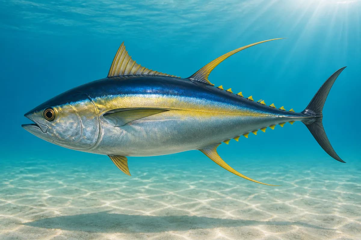
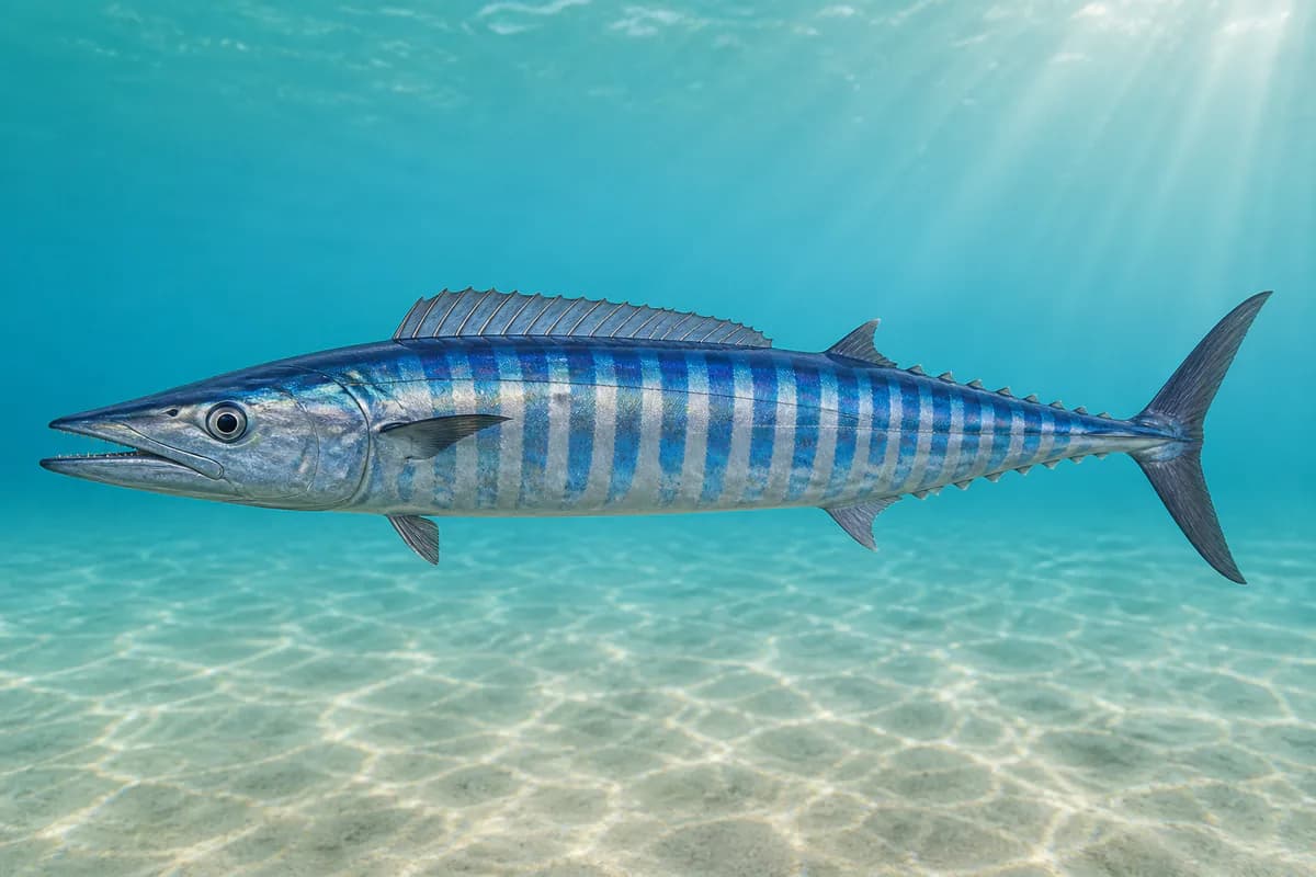
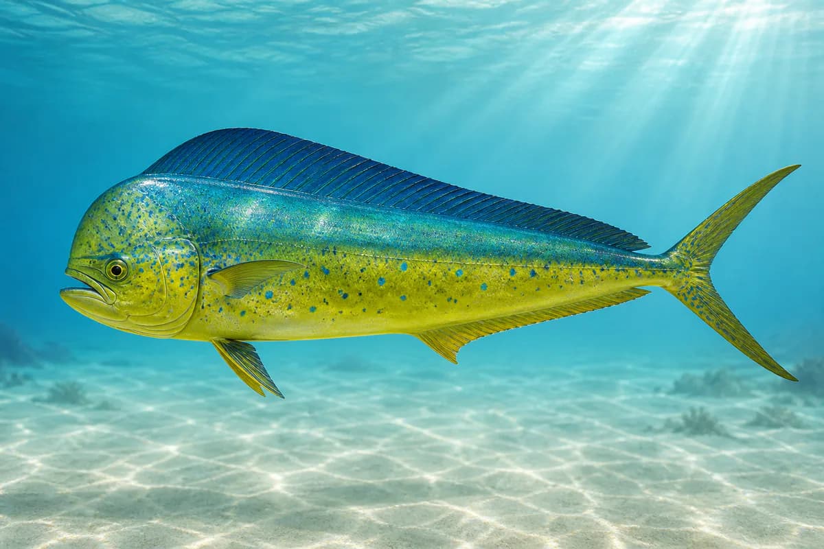
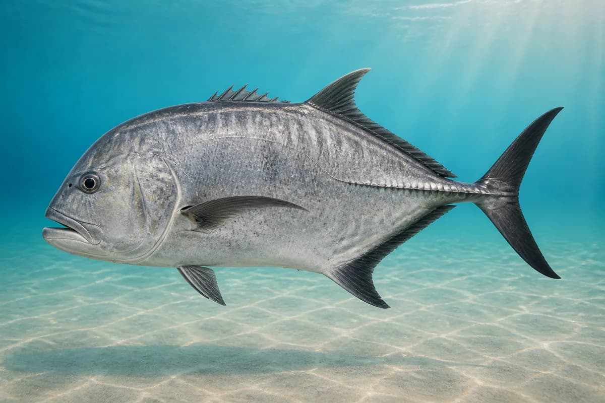
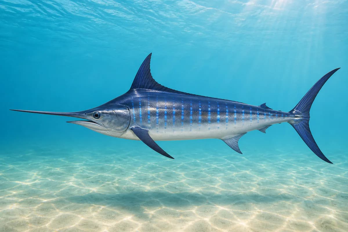
Species images are AI-generated illustrations for visual reference and may simplify natural variation. Fishery records are based on the cited agency and editorial sources. About fish illustrations

  • Pacific blue marlin illustration

    Pacific blue marlin

    Primary

    Makaira nigricans

    Also called Blue marlin

    No seasonal pulse known

    Kona lee billfish charter identity. Destination month timing is not encoded as a legal season.

  • Yellowfin tuna illustration

    Yellowfin tuna (ahi)

    Primary

    Thunnus albacares

    Also called Ahi

    No seasonal pulse known

    Kona pelagic ahi. Occurrence is documented; destination month timing is not encoded as a legal season.

  • Wahoo illustration

    Wahoo (ono)

    Primary

    Acanthocybium solandri

    Also called Ono

    No seasonal pulse known

    Kona pelagic ono. Occurrence is documented; destination month timing is not encoded as a legal season.

  • Mahi-mahi illustration

    Mahi-mahi

    Primary

    Coryphaena hippurus

    Also called Dorado

    No seasonal pulse known

    Kona pelagic mahi-mahi. Occurrence is documented; destination month timing is not encoded as a legal season.

  • Giant trevally illustration

    Ulua / papio

    Secondary

    Caranx ignobilis

    Also called Ulua

    No seasonal pulse known

    Harbor and nearshore jack fishery. Do not treat this as a Deep 7 bottomfish identity.

Profile guidance — exact seasonal timing is not available for every target.

Access, Safety and Regulations

Access

Public harbor and charter fleet at Honokohau. Nonresident marine license required. Deep 7 vessel registration applies if targeting Deep 7. West Hawaii FMA is an overlay, not the pin name.

Primary hazards

Open-ocean pelagic water, heat, and harbor traffic. Do not substitute Hilo 51206 for Kona wave.

Fishery considerations

  • Tide is NOAA 1617433 Kawaihae, nearby. Harbor water level is not Kona shoreline surf. Wave is SOURCE_GAP and must not be treated as calm.
  • Lee thermal winds and trades are destination-facing. Offshore wind is not automatically favorable. This profile does not score wind.

Regulations

Size limits, seasons, and possession rules change. Verify the current official regulations before fishing.

Location and Access

Cataloged coastal fishing destination

Harbor · Hawaii

Loading map…

The map marker represents the cataloged waterbody or monitoring location and may not indicate legal parking or public access. Confirm access through the official information before visiting.

Data Sources

Planning limitation

Coastal conditions can vary over short distances. Predictions and remote observations are planning information, not guarantees of access or safety.

  • Pin is Honokohau Small Boat Harbor and the west-Hawaii pelagic run, not Hilo and not Kawaihae Harbor itself.
  • Offshore 510xx buoys are regional context only, not local Hs.
  • Missing waves are not calm water. Forecast/prediction is not observation.
  • Current Coastal Rating is a provisional public-Beta rating. The regional methodology is still calibrating and is not formally accepted. The verdict is capped at Consider while calibration and evidence remain limited. Coastal Estimated is unauthorized.
  • Customer Current Coastal Rating is unavailable. HAWAII_TROPICAL_PACIFIC_V1 is a candidate only. PATH1 and PATH2 are not authorized now. Physical readings are not an ordinal rating.