Coastal conditions

Fort Pierce Inlet

Inlet · Florida · Florida Atlantic / Space and Treasure Coasts

Current Coastal Rating

Fair · 56

Beta

Conditions are fair, but confidence is reduced because some coastal inputs are partial or prediction-based.

Scores are model-specific and are not directly comparable across water types.

Should I Go?

Trip conditions only. Target-species activity and seasonal fishery patterns are not yet included.

Consider

Trip conditions may be workable, but important cautions or data limitations remain.

High confidence in the evaluated inputs — observational coverage is partial. Required data sources were available and the key inputs were current.

Evaluates trip conditions using weather, tides, currents, waves, daylight, and active alerts.

  • Provisional public-Beta coastal rating. Methodology is not formally calibrated.
  • Numeric class: NEEDS_BOUNDED_PRODUCT_POLICY_DEFAULTS. Not an empirical fishing freeze.
  • Does not inherit Northeast or cross-region fishing thresholds.
  • Missing waves are not calm. Forecast is not an observation. Prediction is not an observation.
  • Verdict capped at Consider while calibration remains incomplete or evidence is limited.

About this recommendation

Uses StrikeTracks coastal policy 2026-07.

Service Status

Degraded

Coastal conditions are partial, stale, or predictions-only.

Recommended window

Saturday · 9:00 AM–12:00 PM EDT

Window score

81

Max wind
8 mph
Max gust
13 mph
Daylight
100% of window
Tide state
rising
Current event
Slack in window

Why

  • Strong daylight coverage supports the evaluated window.

Current Readings

No recent observations are available.

Past 7 Days

No recent observations are available.

Nearby coastal destinations

  • Florida · Florida Atlantic / Space and Treasure Coasts · Inlet

    Approximately 28.7 miles away

  • Florida · Palm Beach / Lake Worth Atlantic reef and bluewater · Offshore

    Approximately 54.8 miles away

  • Florida · Florida Atlantic / Southeast · Shore

    Approximately 61.3 miles away

Predicted Tides

Predicted

Falling

Next low tide

Sep 5, 2026, 9:13 AM

In 5 hr 23 min

0.4 ft MLLW

Previous

High · Sep 5, 2026, 2:48 AM · 2.8 ft MLLW

Following

High · Sep 5, 2026, 3:55 PM · 2.9 ft MLLW

Tide station at destination

Fort Pierce Inlet · NOAA 8722212

Predicted Tidal Current

Predicted

Current predicted speed is not available for this interval.

Next: Slack · 4:54 AM · 0.0 knots

Following: Max ebb · 7:49 AM · 3.1 knots

Current prediction station at destination

Fort Pierce Inlet Entrance · NOAA FPI0901 · 0.3 mi from destination

NOAA current station

Planning note

These values are tidal-current predictions, not real-time observed currents. They describe conditions near this prediction station rather than the entire surrounding coastal area.

Data coverage

This station provides max-current and slack-water events, but not a continuous current-speed timeline.

Tidal-current timing can differ from high and low tide timing.

Fishery Profile

Fishery Overview

Fort Pierce Inlet jetty and pass fishery

A Treasure Coast Atlantic inlet fishery at Fort Pierce Inlet. The south jetty and inlet shoreline inside Fort Pierce Inlet State Park, and the pass itself, concentrate snook, red drum, spotted seatrout, bluefish, and southern flounder moving between the Indian River Lagoon and the Atlantic. This is one destination — Fort Pierce Inlet — not a separate Pepper Park record and not the broader lagoon.

Fishery type
  • Jetty inlet pass
Fishing modes
  • Shore
  • Inshore boat
Habitat and structure
Fort Pierce Inlet south jetty and rock shoreline inside the state park · Deep Atlantic inlet between North Hutchinson Island and the Fort Pierce / south jetty shore · Current seams, granite toes, and the Indian River Lagoon exchange immediately inside the pass

Static seasonal guidance · Last reviewed Aug 15, 2026

Not a live bite forecast.

Fishery Targets

Fort Pierce Inlet State Park names snook, red drum, trout, bluefish, and flounder among inlet catches, including fish migrating along the coast or passing through the inlet at certain times of year. This profile does not encode month windows because available evidence is occurrence-level, not a destination fishing calendar, and does not treat listed targets as typical every-month fishing quality. FWC harvest seasons are not biological calendars. Seasonal notes, where present, describe typical presence, not a legal harvest season.

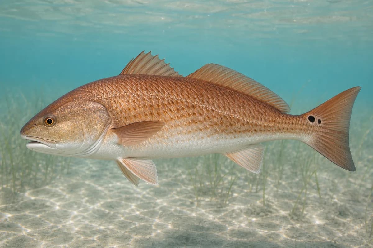
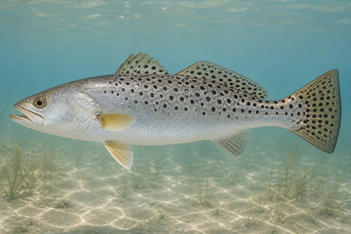
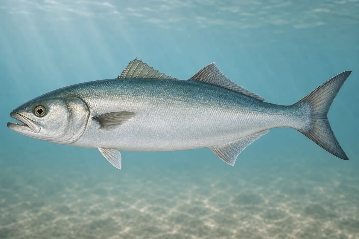
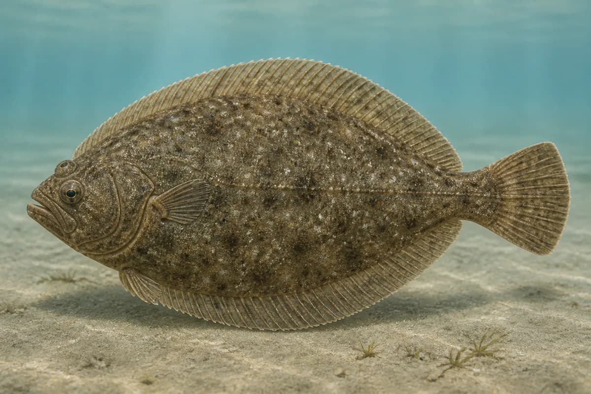
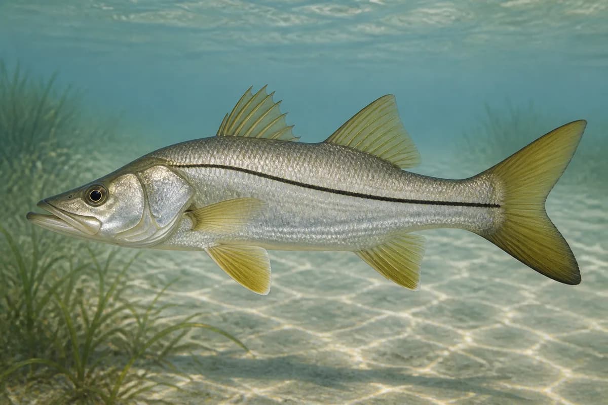
Species images are AI-generated illustrations for visual reference and may simplify natural variation. Fishery records are based on the cited agency and editorial sources. About fish illustrations

  • Common snook illustration

    Common snook

    Primary

    Centropomus undecimalis

    Currently in a typical seasonal window

    Typical seasonal window: MAY — SEPTEMBER

    Fort Pierce Inlet State Park names snook among inlet catches. FWC places Atlantic abundance from about Cape Canaveral south, so this Treasure Coast inlet is inside the core range. Cold-sensitive; destination month timing is not encoded from harvest seasons or statewide occurrence.

  • Red drum illustration

    Red drum

    Primary

    Sciaenops ocellatus

    Also called Redfish

    No seasonal pulse known

    Named by Fort Pierce Inlet State Park. FWC treats red drum as a widespread Florida estuarine sportfish that spawn in passes and inlets; that biology is not encoded as a destination month calendar.

  • Spotted seatrout illustration

    Spotted seatrout

    Secondary

    Cynoscion nebulosus

    No seasonal pulse known

    Named as trout by Fort Pierce Inlet State Park. FWC seatrout habitat is coastal grass and sand; lagoon edges inside the inlet are the relevant class, not a month window.

  • Bluefish illustration

    Bluefish

    Secondary

    Pomatomus saltatrix

    No seasonal pulse known

    Named by Fort Pierce Inlet State Park among migrating coastal catches. Migratory timing is not given exact month endpoints here.

  • Southern flounder illustration

    Southern flounder

    Secondary

    Paralichthys lethostigma

    No seasonal pulse known

    Named as flounder by Fort Pierce Inlet State Park. FWC describes southern flounder as an inshore/estuarine flatfish thought to spawn offshore; that is not a destination fishing calendar.

Typical Seasonal Targets

  • Common snook — MAY — SEPTEMBER

Seasonal presence is general guidance and does not indicate current fish activity.

How to Fish Fort Pierce Inlet

Typical September approaches include inlet jetty and current-seam casting for Common snook.

  • Inlet jetty and current-seam casting

    Cast paddle tails, swimming plugs, and poppers along the south jetty rocks and moving-water seams for snook, red drum, seatrout, and bluefish.

    Best for

    • Common snook

    Modes

    • Shore
    • Inshore boat

    Setup

    • Fort Pierce Inlet casting setup

Common Tackle Setups

  • Fort Pierce Inlet casting setup

    Shore or boat spinning tackle for snook and red drum along the inlet jetties.

    Rod
    Medium to medium-heavy spinning rod; a longer rod helps lift rigs over granite from shore
    Reel
    Spinning reel with a reliable drag
    Main line
    Braided main line with abrasion resistance near rock
    Leader
    Fluorocarbon or abrasion-resistant mono leader; snook gill covers are sharp
    Terminal tackle
    Jig heads matched to current; Snaps or loops suited to plugs and soft plastics
    Presentation
    FWC: snook face moving water and wait for prey; work current seams rather than slack pockets only; This profile does not score a trip window

    Used for

    • Inlet jetty and current-seam casting

Typical September Lures and Flies

Common lure and fly families associated with this month’s techniques.

  • Surface popper

    Lure
    • Common snook

    Surface · Twitch, pause

    Use short pops rather than constant noise in clear or pressured water

  • Minnow-style swimming plug

    Lure
    • Common snook

    Shallow to midwater · Steady, twitch, pause

    Cast across seams and let the plug track with the current

  • Soft-plastic paddle tail

    Lure
    • Common snook

    Shallow, Midwater, Variable · Steady, twitch, jig

    Swim steadily through seams or hop lightly near bottom transitions

  • Bucktail jig

    Lure
    • Common snook

    Shallow, Midwater, Bottom, Variable · Jig, twitch, steady, drift

    Hop, swim, or drift depending on depth and current speed

General seasonal guidance, not a live recommendation, product endorsement, or guarantee of success.

Access, Safety and Regulations

Access

Public shore fishing is reached through Fort Pierce Inlet State Park on North Hutchinson Island (905 Shorewinds Drive, Fort Pierce). Florida State Parks posts park hours, vehicle entry fees, and that inlet fishing is a primary shore activity; confirm current hours, fees, and jetty postings before you go. The north jetty is a separate shore approach and is not treated as this park walk-up. Boat anglers use the pass; this profile does not name an unverified ramp as the destination access.

Primary hazards

Strong tidal current, slick granite, and boat traffic in the inlet are the primary hazards. Lightning, heat, and breaking swell on the jetty rocks are routine Atlantic inlet risks. This profile does not change recommendation or rating scoring.

Fishery considerations

  • Tidal current through Fort Pierce Inlet is the dominant fishing context. This profile does not score currents or change the coastal rating.
  • Wind against current can steepen the inlet. Waves are intentionally unsupported at this destination.

Regulations

Size limits, seasons, and possession rules change. Verify the current official regulations before fishing.

Fishery Sources

Editorial and agency sources supporting this fishery profile. Live and predicted conditions use the separate Data Sources section.

Location and Access

Cataloged coastal fishing destination

Inlet · Florida

Loading map…

The map marker represents the cataloged waterbody or monitoring location and may not indicate legal parking or public access. Confirm access through the official information before visiting.

Data Sources

Planning limitation

Coastal conditions can vary over short distances. Predictions and remote observations are planning information, not guarantees of access or safety.