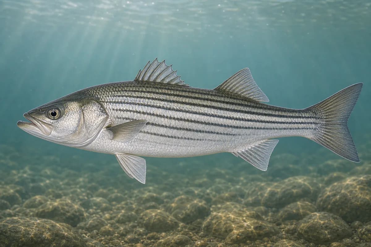
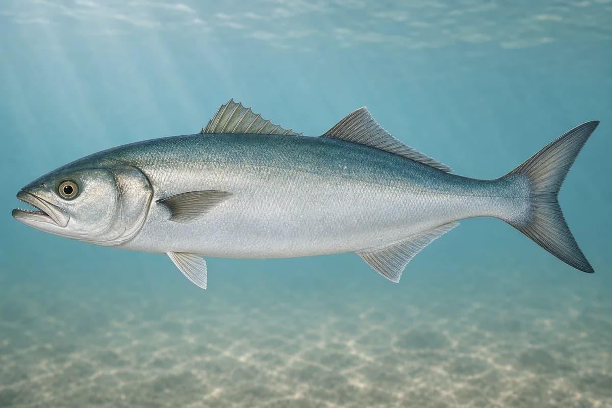
Cape Cod Bay at Brewster Flats is a shallow tidal-flats fishery where broad sand and mud flats alternately expose and flood across the Brewster shoreline. Striped bass are the primary target, with bluefish adding a secondary pelagic opportunity to a fishery defined by wading water and expansive tidal structure.
Active coastal or marine alerts
Gale Warning
Severity: Moderate
Gale Warning issued October 20 at 2:16AM EDT until October 21 at 8:00PM EDT by NWS Boston/Norton MA
Begins Oct 20, 2026, 2:16 AM · Ends Oct 21, 2026, 8:00 PM
Mariners should alter plans to avoid these hazardous conditions. Remain in port, seek safe harbor, alter course, and/or secure the vessel for hazardous conditions.
Conditions are mixed. Review the details below before heading out.
Should I Go?
Trip conditions only. Target-species activity and seasonal fishery patterns are not yet included.
Do Not Go
Safety gate
An active marine warning affects this destination.
See the active alert cards above for official details.
Evaluates trip conditions using weather, tides, currents, waves, daylight, and active alerts.
Service Status
Degraded
Coastal conditions are partial, stale, or predictions-only.
Why
An active marine warning affects this destination.
Current Readings
Updated Oct 20, 2026, 5:57 AM
Marine Buoy
Marine Buoy selected
No sufficiently recent observations are available for this source.
Past 7 Days
Marine Buoy
Marine Buoy selected
Water temperature
Window Oct 13, 2026, 5:57 AM – Oct 20, 2026, 5:57 AM (rolling 168 hours)
Water temperature over the past 7 days. 329 observations · from Oct 13, 2026, 6:00 AM · to Oct 20, 2026, 2:00 AM Range 58.5°F to 64.8°F.
Available observations were broadly steady.
329 observations · from Oct 13, 2026, 6:00 AM · to Oct 20, 2026, 2:00 AM
NDBC · Cape Cod Bay, MA · Station 44090
Nearby marine station
Approximately 14 mi from destination
Observation type: observed
Unit: °F
Regional buoy measurements may differ from protected or nearshore conditions at this destination. Significant wave height is not shoreline surf or breaker height.
This nearby station is used for tide timing. Predicted height does not represent exact water depth or exposed-flat conditions at Brewster Flats.
Predicted Tidal Current
Predicted
Tidal-current predictions are not available for this destination.
Tidal-current timing can differ from high and low tide timing.
Fishery Profile
Fishery Overview
Cape Cod Bay Brewster Flats wade fishery
A shallow tidal-flats fishery on the Brewster side of Cape Cod Bay where wide sand and mud flats expose and flood with the tide. The destination is a wade-oriented striped bass fishery with bluefish as a secondary warm-season presence. Tide awareness and a planned return route are essential.
Fishery type
Shallow tidal
Flats
Wade
Fishing modes
Wade
Shore
Habitat and structure
Broad shallow sand and mud tidal flats · Tide-dependent channels, guts, and bar edges · Flooding flats that concentrate bait in skinny water · Wadeable nearshore bay bottom that changes depth quickly with the tide
Static seasonal guidance · Last reviewed Jul 18, 2026
Not a live bite forecast.
Fishery Targets
Striped bass are the primary flats target from late spring through early fall when bait uses the shallow Brewster shoreline. Bluefish are a secondary warm-month presence and are less central to the skinny-water story than striped bass. Winter and early spring are generally outside the main flats fishery window described here.
Species images are AI-generated illustrations for visual reference and may simplify natural variation. Fishery records are based on the cited agency and editorial sources. About fish illustrations
Striped bass
Primary
Morone saxatilis
Currently in a typical seasonal window
Typical seasonal window: MAY — OCTOBER
Primary flats target when bait and tide stage align on the Brewster flats.
Bluefish
Secondary
Pomatomus saltatrix
Typical seasonal window: JUNE — SEPTEMBER
Typical Seasonal Targets
Striped bass — MAY — OCTOBER
Bluefish — JUNE — SEPTEMBER
Seasonal presence is general guidance and does not indicate current fish activity.
How to Fish Cape Cod Bay at Brewster Flats
Typical October approaches include flats wading and sight casting and channel and bar-edge presentations for Striped bass.
Flats wading and sight casting
Wade carefully on the flooding or ebbing flats and present flies, soft plastics, or light plugs to striped bass working bait in skinny water.
Best for
Striped bass
Modes
Wade
Shore
Setup
Flats wading setup
Channel and bar-edge presentations
Fish deeper guts and bar edges when fish drop off the open flats as water falls or push up on the flood.
Best for
Striped bass
Modes
Wade
Shore
Setup
Channel-edge flats setup
Common Tackle Setups
Flats wading setup
Lighter spinning or fly tackle for shallow-water wading presentations and sand-eel or baitfish imitations aimed at striped bass on the Brewster flats.
Rod
Light to medium spinning rod, or a fly rod suited to shallow flats casting.
Reel
Lightweight spinning reel, or a fly reel balanced to the rod.
Main line
Lighter braid or floating/intermediate fly line suited to shallow water.
Leader
Modest leader length appropriate for clear shallow water and light presentations.
Terminal tackle
Minimal terminal tackle appropriate for shallow water.; Light jigs or simple connections that do not overpower the presentation.
Presentation
Favor shallow-water wading presentations and keep casts quiet in skinny water.
Used for
Flats wading and sight casting
Channel-edge flats setup
Slightly more versatile light tackle for channel edges and slightly deeper flats transitions for striped bass and bluefish.
Rod
Light to medium spinning rod with enough tip for soft plastics and enough backbone for bluefish.
Reel
Lightweight spinning reel with a reliable drag.
Main line
Light braid suited to casting across flats and edges.
Leader
Leader with enough abrasion resistance for bluefish when needed.
Terminal tackle
Light jigs or simple loops for soft plastics and small plugs.
Presentation
Work channel edges and slightly deeper transitions without overloading shallow-water tackle.
Used for
Channel and bar-edge presentations
Typical October Lures and Flies
Common lure and fly families associated with this month’s techniques.
Use as a swimming baitfish or on a jig head for structure and edges
Soft-plastic sand eel
Lure
Striped bass
Shallow to midwater · Steady, twitch, slow
Swim or twitch just above the bottom on flats and bar edges
Flies
General baitfish streamer
Fly
Striped bass
Modes
Wade
Shore
Shallow to midwater · Steady, twitch, swing
Strip with short pauses so the fly tracks naturally through seams
Weighted minnow fly
Fly
Striped bass
Modes
Wade
Shore
Shallow to midwater · Fast, steady, twitch
Use a brisk strip when fish are moving quickly
Sand-eel fly
Fly
Striped bass
Modes
Wade
Shore
Shallow · Steady, slow, swing
Present across or slightly down-current and keep the fly near the bottom without snagging
Flatwing-style streamer
Fly
Striped bass
Modes
Wade
Shore
Shallow to midwater · Swing, slow, steady
Let the fly breathe on a slow swing or gentle strip
General seasonal guidance, not a live recommendation, product endorsement, or guarantee of success.
Access, Safety and Regulations
Access
This fishery profile describes the Brewster Flats destination on Cape Cod Bay. Public beach and shoreline access in Brewster is governed by town and related public-access rules, which can include seasonal parking limits and shoreline restrictions. Confirm current town beach access, parking, and any local ordinances before wading. Nearby harbors or tide-proxy stations is not the fishing destination.
Primary hazards
Rapidly changing water depth, soft bottom, fog, and long distances from shore are the main hazards. Wade with a conservative exit plan, watch the flood behind you, and turn around early if the return path is narrowing. Never assume you can outwalk a rising tide across broad flats.
Fishery considerations
Tide stage controls both access and fishable water depth on the Brewster flats. Depth can change quickly on the flood and leave anglers far from shore on the ebb. Always plan a return route before wading out, and treat falling water as a hard constraint on how far you travel. A live access window is not calculated.
Strong onshore wind can reduce visibility on the flats, chill wading anglers, and make a long return more difficult. Fog and low light also reduce the ability to track channels and exit paths.
Regulations
Size limits, seasons, and possession rules change. Verify the current official regulations before fishing.
The map marker represents the cataloged waterbody or monitoring location and may not indicate legal parking or public access. Confirm access through the official information before visiting.