Coastal conditions

Santa Barbara Harbor

Harbor · California · Southern California coast

Current Coastal Rating

Fair · 56

Beta

Conditions are fair, but confidence is reduced because some coastal inputs are partial or prediction-based.

Scores are model-specific and are not directly comparable across water types.

Should I Go?

Trip conditions only. Target-species activity and seasonal fishery patterns are not yet included.

Consider

Trip conditions may be workable, but important cautions or data limitations remain.

High confidence in the evaluated inputs — observational coverage is partial. Required data sources were available and the key inputs were current.

Evaluates trip conditions using weather, tides, currents, waves, daylight, and active alerts.

  • Provisional public-Beta coastal rating. Methodology is not formally calibrated.
  • Numeric class: RESEARCH_SUPPORTED_PROVISIONAL_NUMERICS_POSSIBLE. Not an empirical fishing freeze.
  • Does not inherit Northeast or cross-region fishing thresholds.
  • Missing waves are not calm. Forecast is not an observation. Prediction is not an observation.
  • Verdict capped at Consider while calibration remains incomplete or evidence is limited.

About this recommendation

Uses StrikeTracks coastal policy 2026-07.

Service Status

Degraded

Coastal conditions are partial, stale, or predictions-only.

Recommended window

Saturday · 9:00 AM–12:00 PM PDT

Window score

71

Max wind
5 mph
Max gust
8 mph
Daylight
100% of window
Tide state
near low

Why

  • Strong daylight coverage supports the evaluated window.

Current Readings

Updated Sep 5, 2026, 12:50 AM

NOAA Station

NOAA Station selected

Source

  • NOAA CO-OPS
  • Santa Barbara station
  • 0.0 mi from destination
Water level
0.9 ft MLLW

Updated 8 min ago

Wind
NNE · 5 mph

Updated 8 min ago

Wind gust
7 mph

Updated 8 min ago

Some observation sources are temporarily unavailable.

Past 7 Days

NOAA Station

NOAA Station selected

Water level

Window Aug 29, 2026, 12:50 AM Sep 5, 2026, 12:50 AM (rolling 168 hours)

Water level over the past 7 days. 1679 observations · from Aug 29, 2026, 12:54 AM · to Sep 5, 2026, 12:42 AM Range 0.8 ft MLLW to 6.2 ft MLLW.

Readings decreased over the available period.

1679 observations · from Aug 29, 2026, 12:54 AM · to Sep 5, 2026, 12:42 AM

  • NOAA CO-OPS · Santa Barbara · Station 9411340
  • Station at destination
  • Approximately 0.0 mi from destination
  • Observation type: observed
  • Unit: ft
  • Datum: MLLW

Nearby coastal destinations

  • California · Santa Cruz Island fishable north-shore shelf west of Scorpion SMR · Offshore

    Approximately 24.6 miles away

  • California · Southern California coast · Shore

    Approximately 73.4 miles away

Predicted Tides

Predicted

Rising

Next high tide

Sep 5, 2026, 7:35 AM

In 6 hr 45 min

3.5 ft MLLW

Previous

Low · Sep 5, 2026, 12:05 AM · 0.2 ft MLLW

Following

Low · Sep 5, 2026, 10:29 AM · 3.2 ft MLLW

Tide station at destination

Santa Barbara · NOAA 9411340

Predicted Tidal Current

Predicted

No representative tidal-current prediction station is configured for this destination.

Tidal-current timing can differ from high and low tide timing.

Fishery Profile

Fishery Overview

Santa Barbara Harbor kelp bass and California halibut fishery

SoCal / Channel transition harbor, Stearns Wharf, and breakwater. Honest catalog targets are kelp bass, California halibut, barred sand bass, and surfperch. White seabass is a boat/kelp companion, not a wharf primary. Spotted sand bass is not a verified Santa Barbara target.

Fishery type
  • Socal harbor bass halibut
Fishing modes
  • Shore
  • Inshore boat
Habitat and structure
Stearns Wharf · Santa Barbara Breakwater · Harbor-mouth kelp and sand edges

Static seasonal guidance · Last reviewed Aug 15, 2026

Not a live bite forecast.

Fishery Targets

Kelp bass and California halibut are the honest harbor fishery year-round. Barred sand bass is a sand/reef companion. White seabass is boat/kelp, with a 1-fish spring limit south of Point Conception.

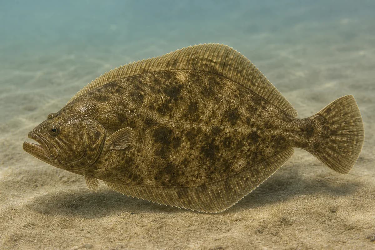
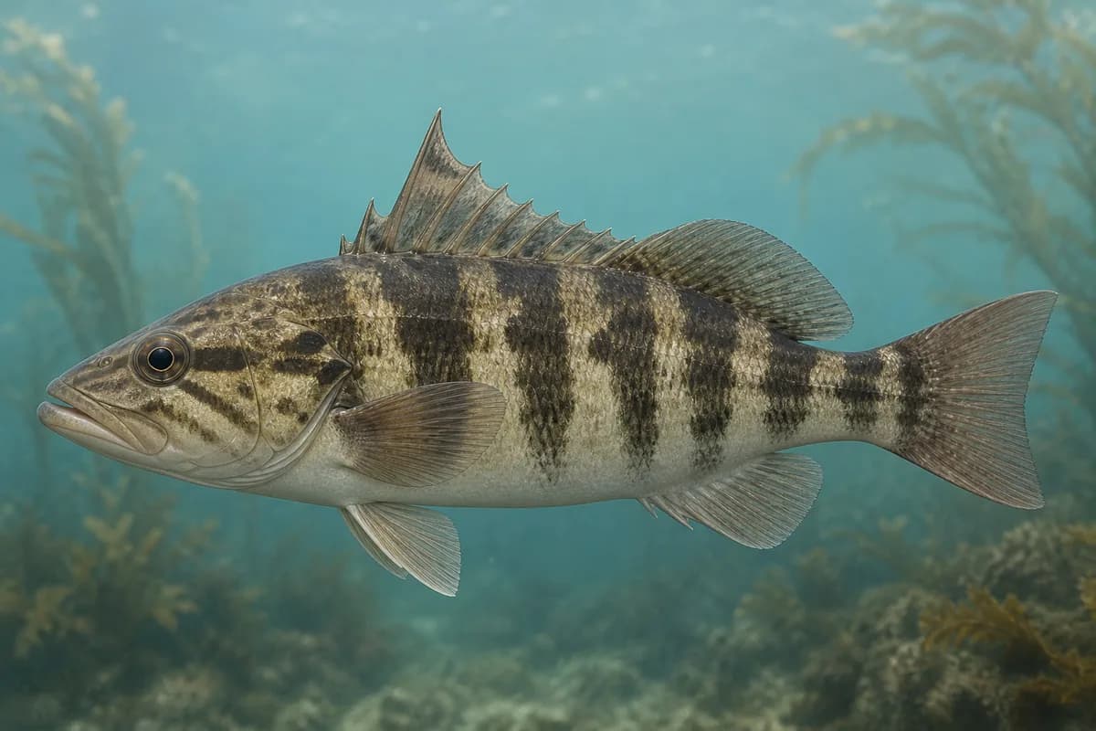
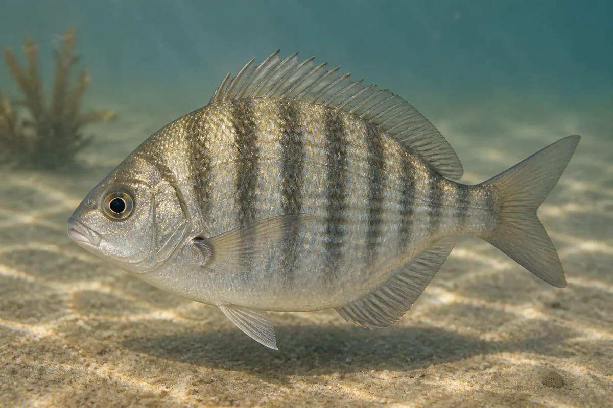
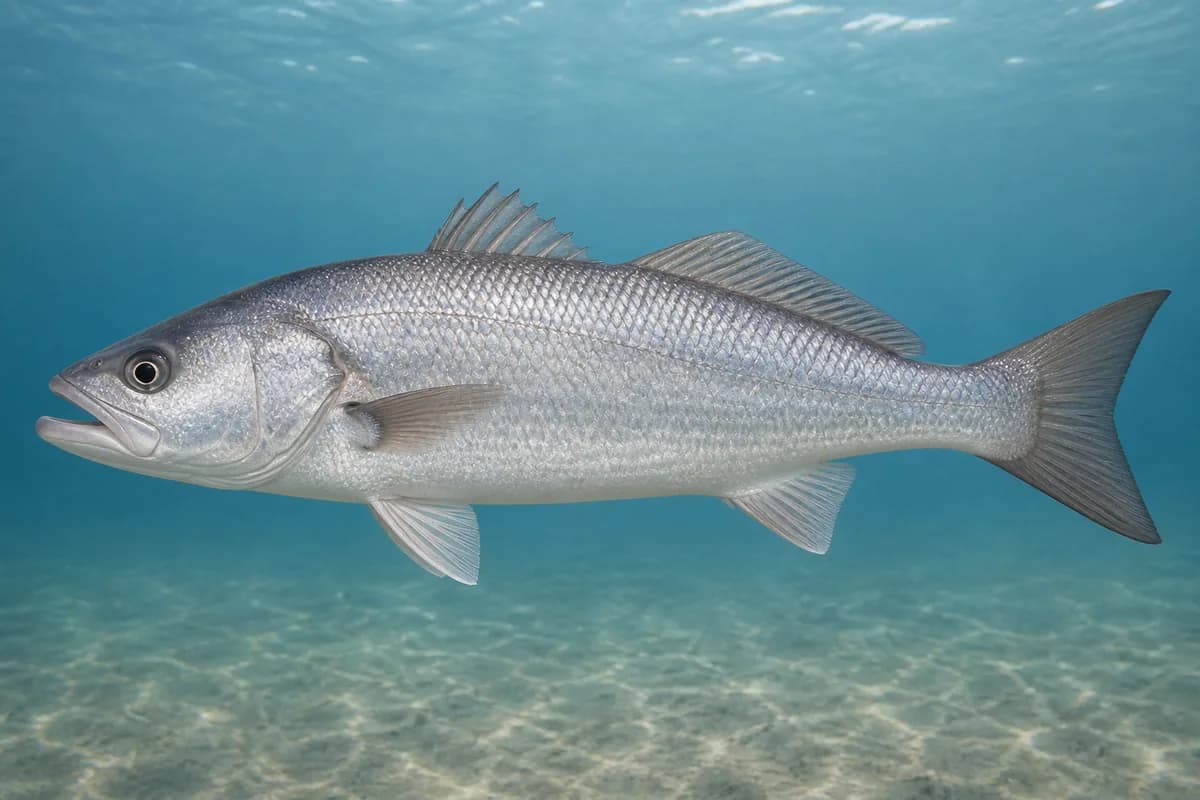
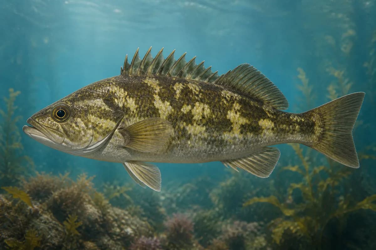
Species images are AI-generated illustrations for visual reference and may simplify natural variation. Fishery records are based on the cited agency and editorial sources. About fish illustrations

  • Kelp Bass illustration

    Kelp bass

    Primary

    Paralabrax clathratus

    Also called calico bass

    No seasonal pulse known

  • California Halibut illustration

    California halibut

    Primary

    Paralichthys californicus

    Also called California flounder

    Currently in a typical seasonal window

    Typical seasonal window: JUNE — OCTOBER

    Year-round typical presence remains an occurrence class. The encoded window is the labeled peak fishing opportunity, not a legal season.

  • Barred Sand Bass illustration

    Barred sand bass

    Secondary

    Paralabrax nebulifer

    No seasonal pulse known

  • Barred Surfperch illustration

    Barred surfperch

    Secondary

    Amphistichus argenteus

    No seasonal pulse known

  • White Seabass illustration

    White seabass

    Seasonal

    Atractoscion nobilis

    Currently in a typical seasonal window

    Typical seasonal window: MARCH — OCTOBER

Typical Seasonal Targets

  • California halibut — JUNE — OCTOBER
  • White seabass — MARCH — OCTOBER

Seasonal presence is general guidance and does not indicate current fish activity.

How to Fish Santa Barbara Harbor

Typical September approaches include harbor-boat kelp and sand and stearns wharf and breakwater fishing for California halibut and White seabass.

  • Harbor-boat kelp and sand

    Boat from the harbor for kelp bass, barred sand bass, California halibut, and white seabass.

    Best for

    • California halibut
    • White seabass

    Modes

    • Shore
    • Inshore boat

    Setup

    • Santa Barbara harbor setup
  • Stearns Wharf and breakwater fishing

    Public-pier perch, mackerel, and occasional bass/halibut from Stearns Wharf and the breakwater.

    Best for

    • California halibut

    Modes

    • Shore
    • Inshore boat

    Setup

    • Santa Barbara harbor setup

Common Tackle Setups

  • Santa Barbara harbor setup

    Light pier gear plus swimming plastics and jigs for bass and halibut. Ocean Enhancement Stamp is required south of Point Arguello where a license is required.

    Rod
    7–9 ft medium spinning
    Reel
    Spinning reel with a smooth drag
    Main line
    15–30 lb braid
    Leader
    Fluorocarbon leader
    Terminal tackle
    Jig heads; Swivels; Dropper loops
    Presentation
    Campus Point SMCA is west at UCSB, not the harbor.

    Used for

    • Harbor-boat kelp and sand
    • Stearns Wharf and breakwater fishing

Typical September Lures and Flies

Common lure and fly families associated with this month’s techniques.

  • Minnow-style swimming plug

    Lure
    • California halibut
    • White seabass

    Shallow to midwater · Steady, twitch, pause

    Cast across seams and let the plug track with the current

  • Soft-plastic paddle tail

    Lure
    • California halibut
    • White seabass

    Shallow, Midwater, Variable · Steady, twitch, jig

    Swim steadily through seams or hop lightly near bottom transitions

  • Bucktail jig

    Lure
    • California halibut

    Shallow, Midwater, Bottom, Variable · Jig, twitch, steady, drift

    Hop, swim, or drift depending on depth and current speed

  • Soft-plastic jig head

    Lure
    • California halibut

    Midwater, Bottom, Variable · Jig, slow, drift

    Keep intermittent bottom contact around structure and soft edges

  • Compact casting metal

    Lure
    • California halibut

    Shallow to midwater · Fast, steady

    Lead showing fish and keep a fast, even retrieve

General seasonal guidance, not a live recommendation, product endorsement, or guarantee of success.

Access, Safety and Regulations

Access

Harbor, Stearns Wharf, and breakwater. Catalog coordinates are NOAA 9411340. A license is not required on a qualifying public pier.

Primary hazards

Boat traffic and slippery rock. Confirm current Southern bass bag/size rules.

Fishery considerations

  • Afternoon west wind is common. South swell can wrap into the harbor mouth.

Regulations

Size limits, seasons, and possession rules change. Verify the current official regulations before fishing.

Location and Access

Cataloged coastal fishing destination

Harbor · California

Loading map…

The map marker represents the cataloged waterbody or monitoring location and may not indicate legal parking or public access. Confirm access through the official information before visiting.

Data Sources

Planning limitation

Coastal conditions can vary over short distances. Predictions and remote observations are planning information, not guarantees of access or safety.

  • Tidal currents remain unsupported.
  • Pacific marine species are not in the current fish-species catalog; static fishery is research-required.