La Push / Quillayute River is an Olympic Peninsula harbor-and-river-mouth fishery where the Quillayute meets the Pacific along jetties, beaches, and rocky coastal structure. Lingcod and chinook salmon are the principal supported targets.
Current Coastal Rating
Fair · 56
Beta
Conditions are mixed. Review the details below before heading out.
Scores are model-specific and are not directly comparable across water types.
Should I Go?
Trip conditions only. Target-species activity and seasonal fishery patterns are not yet included.
Consider
Trip conditions may be workable, but important cautions or data limitations remain.
High confidence in the evaluated inputs — observational coverage is partial. — Required data sources were available and the key inputs were current.
Evaluates trip conditions using weather, tides, currents, waves, daylight, and active alerts.
This coastal rating is in public beta.
Missing waves are not calm. Forecast is not an observation. Prediction is not an observation.
Because this rating is in public beta, recommendations are capped at Consider when evidence is limited.
Recommended window
Tuesday · 10:00 AM–1:00 PM PDT
Window score
81
Max wind
6 mph
Max gust
12 mph
Daylight
100% of window
Tide state
falling
Why
Strong daylight coverage supports the evaluated window.
Current Readings
Updated Oct 20, 2026, 4:38 AM
NOAA Station
NOAA Station selected
No sufficiently recent observations are available for this source.
Past 7 Days
NOAA Station
NOAA Station selected
Water level
Window Oct 13, 2026, 4:38 AM – Oct 20, 2026, 4:38 AM (rolling 168 hours)
Water level over the past 7 days. 1662 observations · from Oct 13, 2026, 4:42 AM · to Oct 20, 2026, 2:48 AM Range -0.6 ft MLLW to 8.8 ft MLLW.
Readings decreased over the available period.
1662 observations · from Oct 13, 2026, 4:42 AM · to Oct 20, 2026, 2:48 AM
NOAA CO-OPS · La Push, Quillayute River · Station 9442396
Washington · Westport MA2 ocean grounds west of Grays Harbor · Offshore
Approximately 70.3 miles away
Predicted Tides
Predicted
Rising
Next high tide
Oct 20, 2026, 9:36 AM
In 4 hr 57 min
6.7 ft MLLW
Previous
Low · Oct 20, 2026, 2:38 AM · 1.6 ft MLLW
Following
Low · Oct 20, 2026, 3:14 PM · 4.0 ft MLLW
Tide station at destination
La Push, Quillayute River · NOAA 9442396
Predicted Tidal Current
Predicted
Tidal-current predictions are not available for this destination.
Tidal-current timing can differ from high and low tide timing.
Fishery Profile
Fishery Overview
La Push / Quillayute River Marine Area 3 fishery
WDFW Marine Area 3 La Push: Queets River north to Cape Alava. La Push is the only direct access point. Anglers target lingcod and Chinook when current MA3 tables are open. This is a boat-access ocean. Distinct from Neah Bay and from the Hoh and Calawah rivers.
Fishery type
Pnw bar entrance jetty
Fishing modes
Inshore boat
Habitat and structure
La Push / Quillayute River boat access · Narrow bar channel · Charted submerged rocks
Static seasonal guidance · Last reviewed Aug 21, 2026
Not a live bite forecast.
Fishery Targets
Ocean Chinook and bottomfish follow current WDFW Marine Area 3 tables. Opening dates and Chinook guideline numbers change and are not fixed here.
This reflects typical biological/fishery timing, not a legal open season. Check current regulations before fishing.
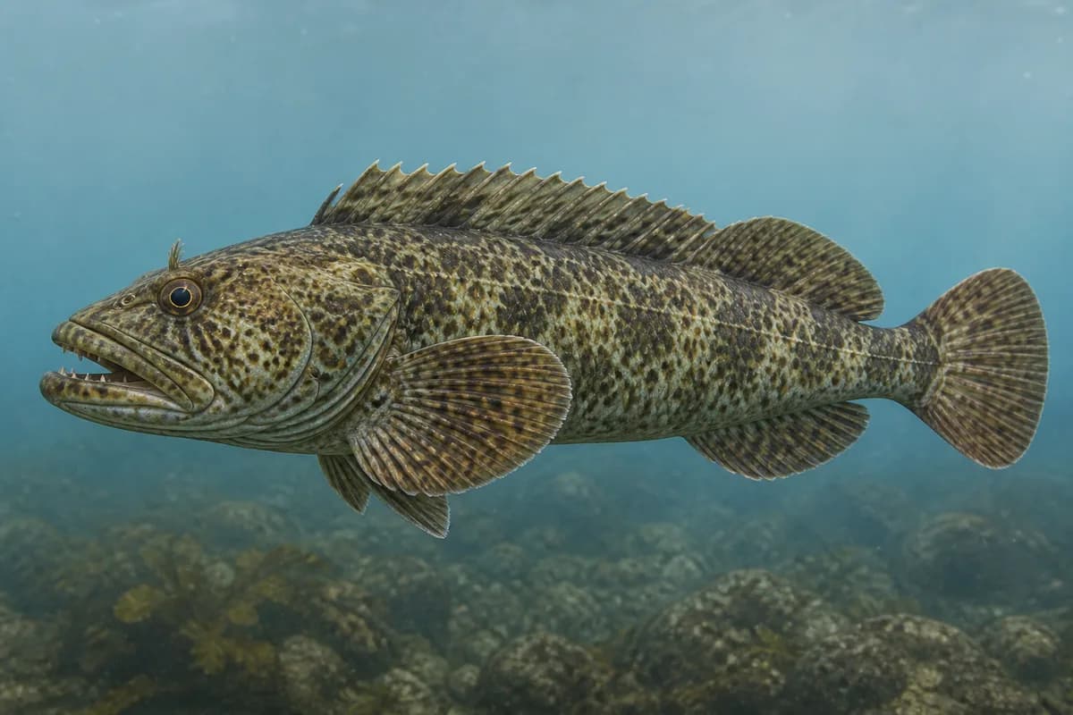
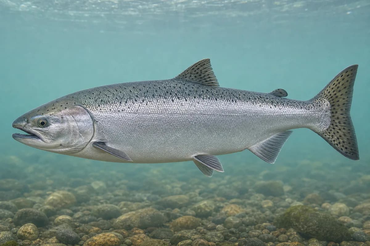
Species images are AI-generated illustrations for visual reference and may simplify natural variation. Fishery records are based on the cited agency and editorial sources. About fish illustrations
Lingcod
Primary
Ophiodon elongatus
Typical seasonal window begins in December
Typical seasonal window: DECEMBER — MARCH
May also be present outside this peak window.
WDFW: bottomfish including lingcod and rockfish typically 3–8 miles; submerged and exposed rocks. Rockfish are part of this fishery.
Chinook salmon
SeasonalRegulations vary annually
Oncorhynchus tshawytscha
Typical seasonal opportunity: SUMMER — EARLY FALL
Typical Seasonal Targets
Lingcod — DECEMBER — MARCH
Chinook salmon — SUMMER — EARLY FALL
Seasonal presence is general guidance and does not indicate current fish activity.
How to Fish La Push / Quillayute River
No profile-based seasonal technique guidance is listed for October.
Preparing for upcoming seasonal targets
La Push ocean boat
Boat access from La Push. Some large ocean-capable boats reach Area 3 from Neah Bay. Bar has a narrow channel. Charted submerged rocks.
Best for
Lingcod
Setup
La Push boat setup
Common Tackle Setups
La Push boat setup
Boat spinning/conventional tackle for lingcod and Chinook when MA3 tables are open. Westport jetty access describes a different harbor.
Rod
8–10 ft medium spinning rod for jetty, harbor, and nearshore work.
Reel
Spinning reel with a smooth drag.
Main line
20–40 lb braid.
Leader
Fluorocarbon or mono leader suited to rock, jetty, and surge.
Terminal tackle
Swivels.; Jig heads.; Hardware suited to current Marine Area rules.
Presentation
Quileute tribal co-management is context.; Pacific halibut is named on the destination page and is part of this fishery. Chinook guideline numbers change and are not fixed here.
Used for
La Push ocean boat
Typical October Lures and Flies
Coming into the seasonal mix
Soft-plastic paddle tail
Lure
Lingcod
Shallow, Midwater, Variable · Steady, twitch, jig
Swim steadily through seams or hop lightly near bottom transitions
Soft-plastic jig head
Lure
Lingcod
Midwater, Bottom, Variable · Jig, slow, drift
Keep intermittent bottom contact around structure and soft edges
Diamond-style jig
Lure
Lingcod
Midwater to variable · Jig, fast, steady
Cast and retrieve with a steady or pulsed cadence through bait schools
General seasonal guidance, not a live recommendation, product endorsement, or guarantee of success.
Access, Safety and Regulations
Access
La Push is the only direct access point for Marine Area 3. Distinct from Neah Bay and from the Hoh and Calawah rivers.
Primary hazards
Narrow channel, submerged rocks, and bar-crossing hazard.
Fishery considerations
WDFW notes a narrower bar than Ilwaco or Westport except in strong southerly wind. Swell and wind can close this port even when predicted tides look usable.
Regulations
Size limits, seasons, and possession rules change. Verify the current official regulations before fishing.
The map marker represents the cataloged waterbody or monitoring location and may not indicate legal parking or public access. Confirm access through the official information before visiting.